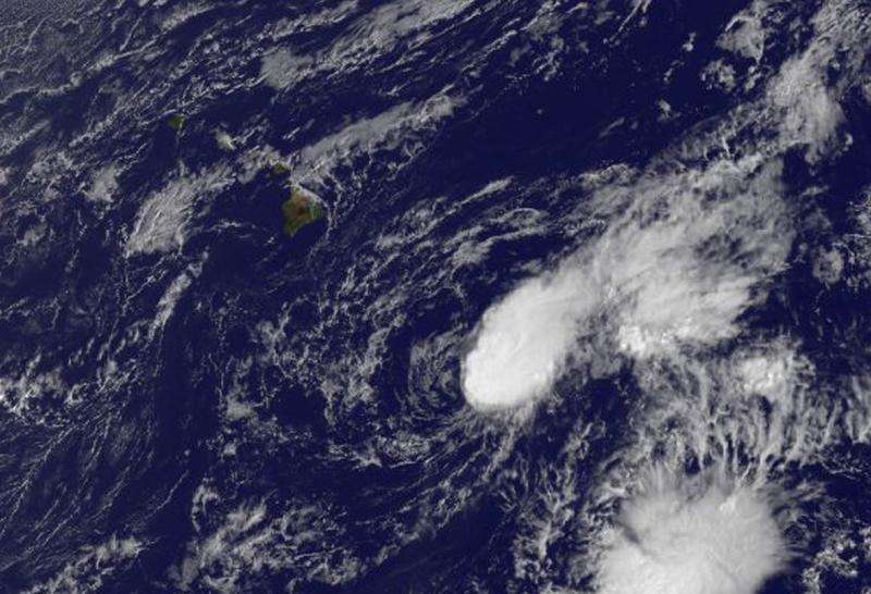
NOAA's GOES-West satellite captured an infrared image of Tropical Depression Nora at 10 a.m. EDT on Oct. 15 that showed the thunderstorms were in a band east of the center of circulation. Credit: NASA/NOAA GOES Project
An infrared satellite image of Tropical Depression Nora taken early on October 15 showed the storm was still holding together south of Hawaii, despite strong wind shear.
NOAA's GOES-West satellite captured an infrared image of Tropical Depression Nora at 1800 UTC (10 a.m. EDT) that showed strong vertical wind shear from the southwest continued pushing the clouds and showers east of the center. The wind shear was blowing at a speed between 30 and 40 knots (34 to 46 mph /55 to 74 kph). The GOES image, created by the NASA-NOAA GOES Project at NASA's Goddard Space Flight Center in Greenbelt, Maryland showed the thunderstorms were in a band east of the center of circulation.
At 5 a.m. EDT (0900 UTC) on October 15, 2015, Nora's maximum sustained winds were near 30 mph (45 kph). It was centered near latitude 16.1 north and longitude 151.9 west. That's about 325 miles (525 km) southeast of Hilo, Hawaii. The depression was moving toward the northwest near 7 mph (11 kph) and is expected to continue in that direction until later in the day when Nora is forecast to take a more westerly track.
NOAA's Central Pacific Hurricane Center expects Nora to become a remnant low pressure area later in the day today, October 15, 2015.
Provided by NASA's Goddard Space Flight Center


