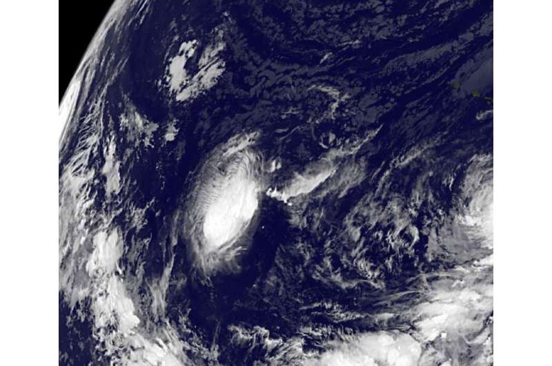
Satellite sees the short life of Tropical Depression 8C

Tropical Depression 8C formed southwest of Hawaii on October 3 and by October 4 it was a post-tropical cyclone. A day later NOAA's GOES-West satellite captured an image of the storm as it tracked in a westerly direction through the Central Pacific Ocean.
When Tropical Depression 8C formed at 5 a.m. HST/11 am EDT on October 3 it was located near latitude 12.0 north and longitude 171.4 west. Maximum sustained winds were near 35 mph (55 kph).
By October 4, Tropical depression Eight-C had weakened and was downgraded to a remnant low. The weak surface low was centered about 1,170 west southwest of Honolulu, Hawaii.
The GOES-West image taken on October 5 at 1500 UTC (11 a.m. EDT) showed that Post-tropical depression 8's remnant low pressure area was an elongated area of clouds. At that time, the remnant low was centered about 1,325 miles southwest of Honolulu, Hawaii, and moving west near 10 mph. The Central Pacific Hurricane Center noted that thunderstorms had been occurring west and northwest of the low, but atmospheric conditions will likely inhibit redevelopment of the system over the next couple of days.
Provided by NASA's Goddard Space Flight Center


