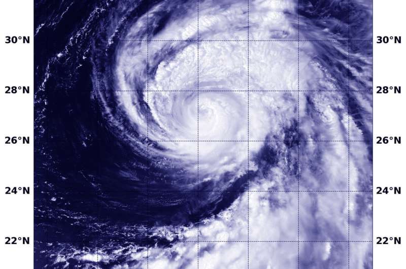
On August 6 at 0354 UTC (Aug. 5 at 11:54 p.m. EDT) the VIIRS instrument aboard NASA-NOAA's Suomi NPP satellite captured a visible image of Typhoon Shanshan in the Northwestern Pacific Ocean. Credit: NOAA/NASA Goddard Rapid Response Team
NASA-NOAA's Suomi NPP satellite caught up with Typhoon Shanahan and provided forecasters with a visible picture of the storm that revealed the storm still maintained an eye, despite weakening.
On August 6 at 0354 UTC (Aug. 5 at 11:54 p.m. EDT) the Visible Infrared Imaging Radiometer Suite (VIIRS) instrument aboard NASA-NOAA's Suomi NPP satellite captured visible image of Shanshan over the open waters of the Northwestern Pacific Ocean. The image showed deep convection or strong development of thunderstorms around the center of circulation and in a large band north of the center.
On August 6 at 11 a.m. EDT (1500 UTC), the Joint Typhoon Warning Center or JTWC noted that Typhoon Shanshan was located near 29.2 degrees north latitude and 145.4degrees east longitude, about 207 nautical miles east-northeast of Chichi Jima, Japan. Shanshan had maximum sustained winds near 70 knots (80.5 mph/129.6 kph) and is on weakening trend. The JTWC noted at that time that "Satellite imagery and a microwave image demonstrate that deep convection has diminished in the last 6 hours and the eyewall and rain bands have become less organized and more ragged."
The JTWC expects Shanshan to move north and maintain current intensity for a day or so, before beginning to weaken. After a close approach to Tokyo, the storm is forecast to curve northeast and turn extra-tropical to the south of Kamchatka.
Provided by NASA's Goddard Space Flight Center


