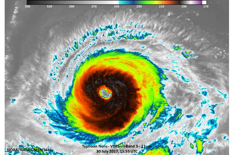
NASA-NOAA's Suomi NPP satellite captured this infrared image of Typhoon Noru on July 30, 2017, at 11:50 a.m. EDT (1550 UTC) in the Northwestern Pacific Ocean. Credit: University of Wisconsin-Madison/CIMSS/William Straka III
NASA-NOAA's Suomi NPP satellite captured an infrared image of Typhoon Noru that showed the structure and cloud top temperatures of the powerful thunderstorms circling its eye.
On July 27, 2017 at 12:24 a.m. EDT (0424 UTC) the Visible Infrared Imaging Radiometer Suite (VIIRS) instrument aboard NASA-NOAA's Suomi NPP satellite provided an infrared image of Typhoon Noru. The VIIRS image revealed very cold cloud top temperatures as cold as 190 Kelvin (minus 83.1 degrees Celsius/minus 117.7 degrees Fahrenheit) in thunderstorms circling the eye. Thunderstorms with cloud tops that high in the troposphere have been shown to generate heavy rain.
At 11 a.m. EDT (1500 UTC) on July 30, the center of Typhoon Noru was located near 23.0 degrees north latitude and 139.3 degrees east longitude. That's about 158 nautical miles southwest of Iwo To Island, Japan. Maximum sustained winds were near 143.8 mph (125 knots/231 kph). Noru was moving to the west at 6.9 mph (6 knots/11.1 kph).
The Joint Typhoon Warning Center forecasts Noru to move slowly to the northwest over the next several days and move toward Kyushu, Japan. Noru is expected to near Kyushu around August 5. Kyushu is the third biggest island of Japan and located farthest southwest of Japan's four main islands.
Provided by NASA's Goddard Space Flight Center


