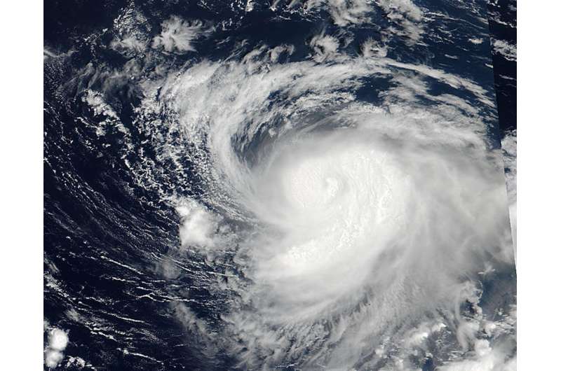
NASA sees Typhoon Noru raging near the Minami Tori Shima Atoll

NASA-NOAA's Suomi NPP satellite captured an image of Typhoon Noru raging near the unpopulated atoll of Minami Tori Shima in the Northwestern Pacific Ocean. Minami-Tori-shima or Marcus Island is an isolated Japanese coral atoll about 1,150 miles (1,850 kilometers) southeast of Tokyo.
On July 24 at 0342 UTC (July 23 at 11:42 p.m. EDT), the Visible Infrared Imaging Radiometer Suite (VIIRS) instrument aboard NASA-NOAA's Suomi NPP satellite provided a visible-light image of Typhoon Noru. The VIIRS image showed a cloud-covered eye surrounded by a thick band of powerful thunderstorms and a thick band wrapping into the center from the southeastern quadrant.
At 11 a.m. EDT (1500 UTC) on July 24, Nuru's maximum sustained winds were near 92 mph (80 knots/148 kph). It was centered near 26.2 degrees north latitude and 154.9 degrees east longitude. That's about 128 nautical miles north of Minami Tori Shima. It was moving to the east-southeast at 13.8 mph (12 knots/22.2 kph).
Noru is located to the southwest of Tropical Storm Koru, which is a much smaller and weaker storm. Noru is moving in a cyclonic loop and is forecast to turn back toward the west by July 26. The Joint Typhoon Warning Center's forecast calls for the storm to approach the island of Iwo To, Japan around July 29.
Provided by NASA's Goddard Space Flight Center


