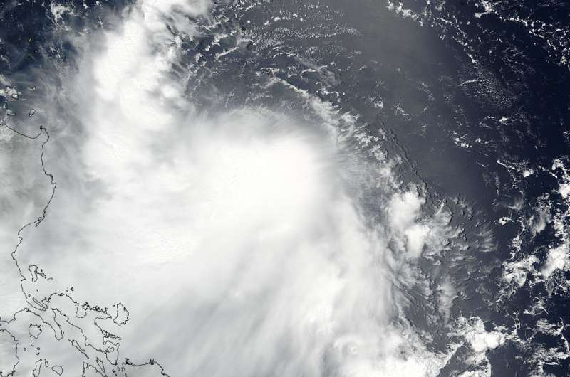
NASA-NOAA's Suomi NPP satellite captured this visible image of Tropical Storm Nesat on July 27, 2017 at 12:24 a.m. EDT (0424 UTC) in the Philippine Sea. The Phillippines are located west (left) of the storm. Credit: NOAA/NASA Goddard Rapid Response Team
NASA-NOAA's Suomi NPP satellite captured an image of Tropical Storm Nesat being affected by vertical wind shear as it parallels the east coast of the Philippines.
On July 27, 2017 at 12:24 a.m. EDT (0424 UTC) the Visible Infrared Imaging Radiometer Suite (VIIRS) instrument aboard NASA-NOAA's Suomi NPP satellite provided a visible-light image of Tropical Storm Nesat as it continued moving north in the Philippine Sea. The VIIRS image showed thunderstorms circling the low-level center and a band of thunderstorms northwest of the center, running parallel to the coast of the Northern Philippines. The image also showed that the bulk of Nesat's clouds were being pushed to the southwest as a result of northeasterly vertical wind shear.
At 11 a.m. EDT (1500 UTC) on July 27, the center of Tropical Storm Nesat was located near 18.9 degrees north latitude and 126.6 degrees east longitude. That's about 415 nautical miles northeast of Manila, Philippines. Maximum sustained winds were near 55 knots 63 mph (55 knots /102 kph). Nesat was moving to the northwest at 9.2 mph (8 knots/14.8 kph).
The Joint Typhoon Warning Center forecasts Nesat to move north then later turn to the northwest while intensifying to 92 mph (80 knots/148 kph) because the wind shear is expected to wane. The system is expected to make landfall in southeastern Taiwan on July 29, cross the Taiwan Strait and make a final landfall in southeastern China on July 30.
Provided by NASA's Goddard Space Flight Center


