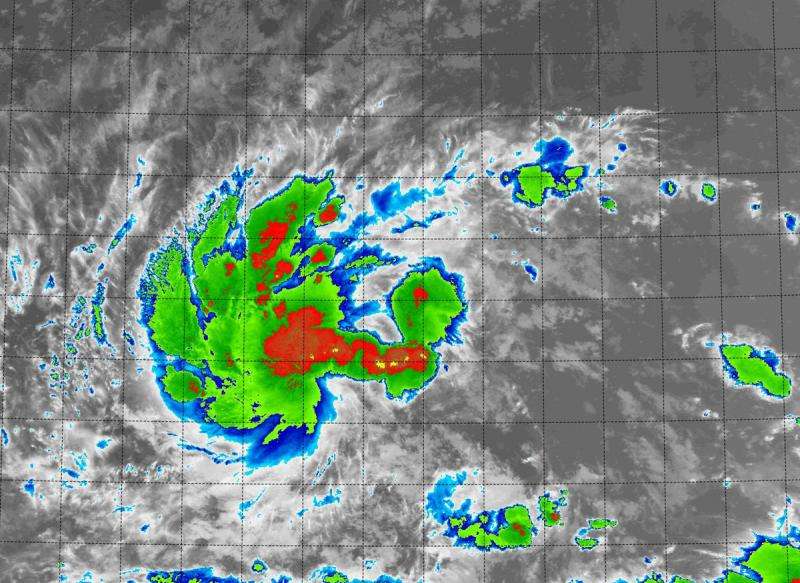
At 3:10 a.m. EDT on August 25, NASA's Terra satellite saw strongest storms (red) west of the center in newborn Tropical Depression 12E in the Eastern Pacific Ocean. Credit: NASA/NRL
The twelfth tropical depression of the Eastern Pacific Ocean hurricane season was born today, August 25, 2015, as NASA's Terra satellite flew overhead.
At 3:10 a.m. EDT on August 25, the MODIS instrument aboard NASA's Terra satellite gathered infrared data on newborn Tropical Depression 12E. The infrared data measures temperatures of cloud tops and found that the coldest and highest thunderstorms were mostly to the west of the circulation center. That's because the depression is being battered by southeasterly wind shear.
At 200 AM PDT (0900 UTC), the center of Tropical Depression Twelve-E was located near latitude 13.2 North, longitude 131.7 West. That's about 1,610 miles (2,595 km) east-southeast of Hilo, Hawaii. Maximum sustained winds remain near 35 mph (55 kph)
The depression was moving toward the west near 5 mph (7 kph) and this general motion with some increase in forward speed is forecast during the next day or so. The estimated minimum central pressure is 1006 millibars.
National Hurricane Center's forecaster Cangialosi said that the wind shear is expected to lessen later in the day on August 25. Lighter wind shear and warm sea surface temperatures will help the storm intensify over the next several days. NHC currently expects the depression to reach hurricane status on August 28.
Provided by NASA's Goddard Space Flight Center


