NASA sees Tropical Depression Danny affecting Leeward Islands

Tropical Depression Danny was already affecting the Leeward Islands when NASA's Terra satellite passed overhead.
The National Hurricane Center noted on August 24, that Danny is expected to produce 2 to 4 inches of rain over the Leeward Islands, the U.S. and British Virgin Islands, and Puerto Rico through Tuesday, August 25.
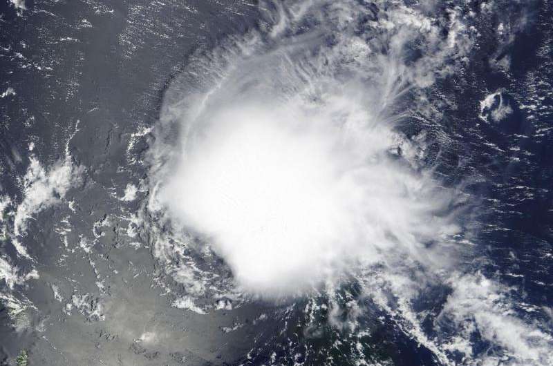
NASA's Terra satellite flew over Danny on August 23 at 14:45 UTC (10:45 a.m. EDT) as it neared the Leeward Islands. The MODIS instrument aboard captured a visible image of the storm when it was still a tropical storm and it still appeared circular. However, the circulation became less apparent in satellite imagery on August 24.
On August 24, NHC reported a strong burst of deep convection (rising air that forms the thunderstorms that make up a tropical cyclone) with cloud top temperatures of -80 degrees Celsius (-112 Fahrenheit) and intense lightning activity that has developed near the alleged center. Infrared instruments, such as the Atmospheric Infrared Sounder that flies aboard NASA's Aqua satellite provide temperature measurements. Cloud top temperatures that high indicate very high, strong thunderstorms with the capability to generate heavy rainfall.
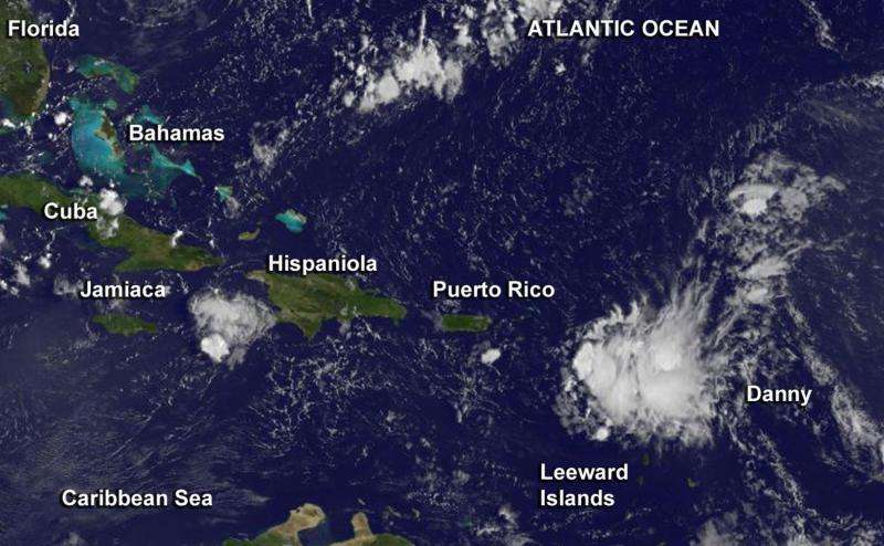
NOAA's GOES-East satellite captured this visible image of Tropical Depression Danny on August 24, 2015 at 11:45 UTC (7:45 a.m. EDT) when it was just 20 miles south of Guadeloupe. The center of Danny's circulation was difficult to pinpoint in the visible GOES image and the storm appeared less circular than it did on the previous day's MODIS image.

At 8 a.m. EDT (1200 UTC) on August 24, Danny had weakened to a depression. The center of Tropical Storm Danny was located near latitude 15.9 North, longitude 61.5 West. That's about 20 miles (30 km) south of Guadeloupe. Danny was moving toward the west near 12 mph (19 kph). Maximum sustained winds had decreased to near 35 mph (55 kph) and NHC forecasts further weakening during the next two days. The estimated minimum central pressure is 1009 millibars.
According to NHC, Danny is now encountering west-northwesterly mid-level wind shear. The subtropical ridge (an elongated area of high pressure moving counter clockwise) located to the north of Danny is expected to remain strong for the next few days, which should force Danny on a westward to west-northwestward track until the system dissipates in about 72 hours.
Provided by NASA's Goddard Space Flight Center


