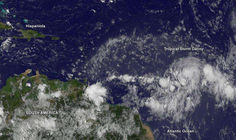
Aqua satellite takes Tropical Storm Danny's temperature

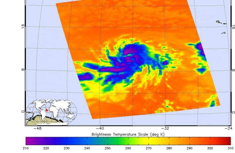
Tropical Depression 4 strengthened into Tropical Storm Danny late on August 19, as NASA's Aqua satellite passed overhead and took its "temperature." That is, infrared data from the AIRS instrument aboard measured cloud top temperatures and sea surface temperatures around the new tropical storm.
On August 18 at 15:47 UTC (1:47 p.m. EDT) the AIRS instrument aboard NASA's Aqua satellite gathered infrared data on Danny as it was strengthening into a tropical storm. In a false-colored image of the data created at NASA's Jet Propulsion Laboratory in Pasadena, California, cloud top temperatures were near -63F/-52C from northeast to east and south of the center. Cloud top temperatures that cold indicate very high, powerful thunderstorms with the capability for generating heavy rainfall.
AIRS data also showed that the sea surface temperatures around the storm were warmer than 300 kelvin (80.3 Fahrenheit/26.8 Celsius), warm enough to maintain and strengthen the tropical cyclone.
On Wednesday, August 19, Forecaster Avila of the National Hurricane Center (NHC) noted that the convection (rising air that forms the thunderstorms that make up the tropical storm) near the center has been intermittent, while a band of thunderstorm has been developing on the eastern semicircle. He said that "the center is difficult to locate on infrared images, and there are some indications that Danny could be moving a little faster."
At 500 AM AST (0900 UTC), the center of Tropical Storm Danny was located near latitude 11.3 North, longitude 40.2 West. About 1,445 miles (2,325 km) east of the Lesser Antilles. Danny was moving toward the west near 14 mph (22 kph), and a track to the west-northwest is expected during the next two days. Maximum sustained winds remain near 50 mph (85 km/h) with higher gusts. Some strengthening is forecast during the next two days. The estimated minimum central pressure is 1000 milllibars.
Danny could become a hurricane on Thursday, August 20. The current forecast by the NHC indicates that Danny will likely reach maximum sustained winds near 105 mph on August 23 before weakening.

Provided by NASA's Goddard Space Flight Center


