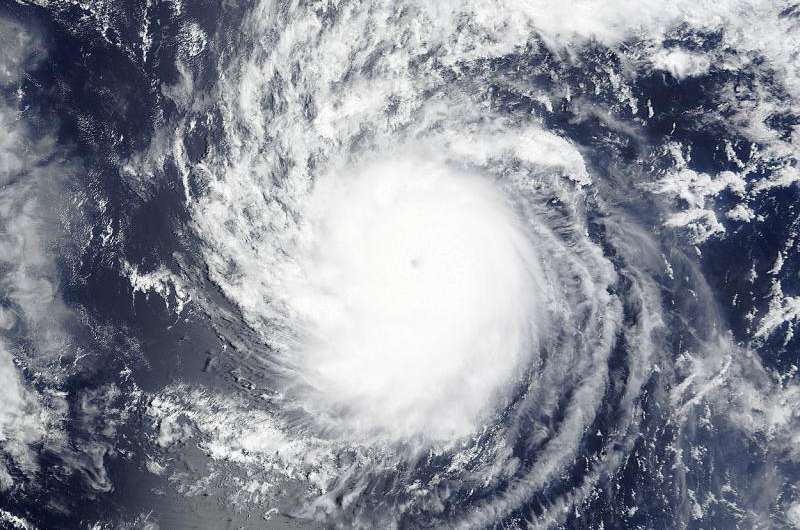
NASA stares Hurricane Hilda in the eye

NASA's Terra satellite passed over Hurricane Hilda and captured an image that clearly showed the storm's eye. Although there are currently no watches or warnings in effect, Hilda is expected to cause rough surf as it moves toward the Hawaiian Islands over the next several days.
The Moderate Resolution Imaging Spectroradiometer or MODIS instrument aboard NASA's Terra satellite captured an image of Hurricane Hilda on August 8 at 20:25 UTC (4:26 p.m. EDT). The MODIS image showed that Hilda had a cloud-free eye with a strong thunderstorms circling the center. The image was created by the MODIS Rapid Response Team at NASA's Goddard Space Flight Center, Greenbelt, Maryland.
Hurricane force winds extended outward up to 25 miles (35 km) from the center and tropical storm force winds extended outward up to 70 miles (110 km).
On Monday, August 10, 2015 at 5 a.m. EDT (0900 UTC/11 p.m. EDT HST, August 9), Hilda's maximum sustained winds were near 100 mph (155 kph). The center of Hurricane Hilda was located near latitude 15.7 north and longitude 149.1 west. That puts the center of Hilda about 480 miles (775 km) southeast of Hilo, Hawaii. Hilda was moving toward the west-northwest near 9 mph (15 kph) and is expected to turn to the northwest over the next couple of day. The estimated minimum central pressure is 974 millibars.
Hurricane Hilda is creating large surf along east and southeast facing shores of the main Hawaiian Islands over the next couple of days.
Forecasters at the Central Pacific Hurricane Center (CPHC) expect steady weakening over the next 48 hours. Hilda is forecast to weaken to a tropical storm on Tuesday, August 11 and by Thursday, August 13 Hilda is expected to move over the Big Island as a depression on its trek to the west-northwest.
Provided by NASA's Goddard Space Flight Center


