NASA sees Tropical Storm Guillermo's big stretch

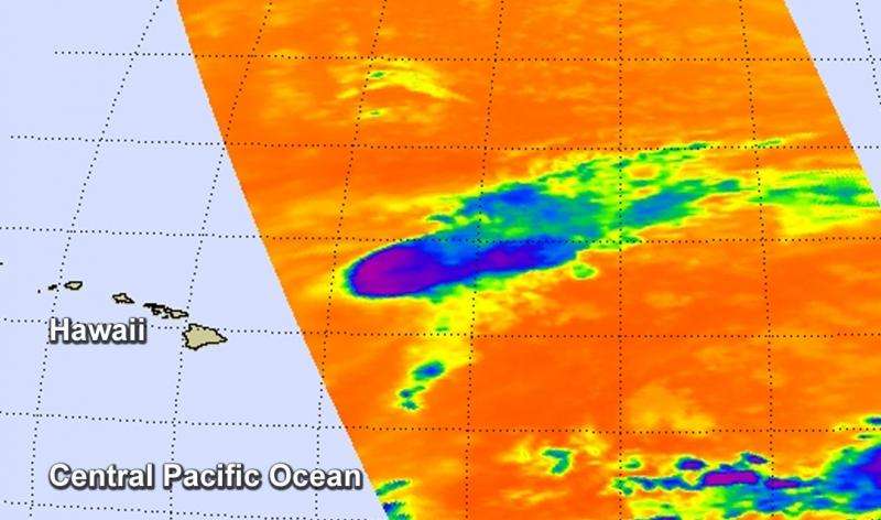
When you look at Tropical Storm Guillermo on infrared NASA satellite imagery it looks stretched out with a "tail" of clouds extending to the northeast. That's because westerly wind shear continues to batter the storm and weaken it.
Strongest thunderstorms and coldest cloud tops near -63F/-53C in Guillermo were pushed east of the center on Aug.5 at 2253 UTC (7:53 p.m. EDT). Infrared data from the Atmospheric Infrared Sounder or AIRS instrument that flies aboard NASA's Aqua satellite captured data that showed the effect of the strong westerly wind shear.
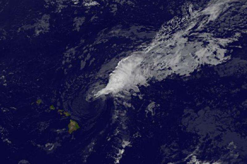
The next day, NOAA's GOES-West satellite provided another infrared look at Guillermo that confirmed the strong vertical wind shear was still happening. In an image taken August 6 at 1200 UTC (8 a.m. EDT), the storm looked almost wedge-shaped.
Because of the asymmetric shape of Guillermo, the tropical storm watch has been discontinued for the islands. However, it remains in effect for the coastal waters northeast of the main Hawaiian Islands from Maui to Kauai.
NOAA's Central Pacific Hurricane Center (CPHC) noted that the swells associated with tropical storm Guillermo will continue to produce large, life threatening surf along east facing shores of the main Hawaiian Islands today, August 6, 2015.
At 0900 UTC (5 a.m. EDT) on August 6, Guillermo's maximum sustained winds are near 50 mph (85 kph), however, steady weakening is expected during the next couple of days as wind shear is expected to continue and the storm is encountering dry air,

The center of storm was located near latitude 21.8 north and longitude 153.2 west. That's about 190 miles (305 km) northeast of Hilo, Hawaii and about 305 miles (490 km) east of Honolulu. Guillermo is moving toward the west-northwest near 10 mph (17 kph) and is expected to continue in that general direction through August 7, however, the CPHC cautioned that any deviation of the track to the left could bring tropical storm force conditions into portions of the windward coastal waters of the islands from Maui to Kauai.
The CPHC forecast noted that Guillermo may become a tropical depression Thursday night or Friday, August 7.
Provided by NASA's Goddard Space Flight Center


