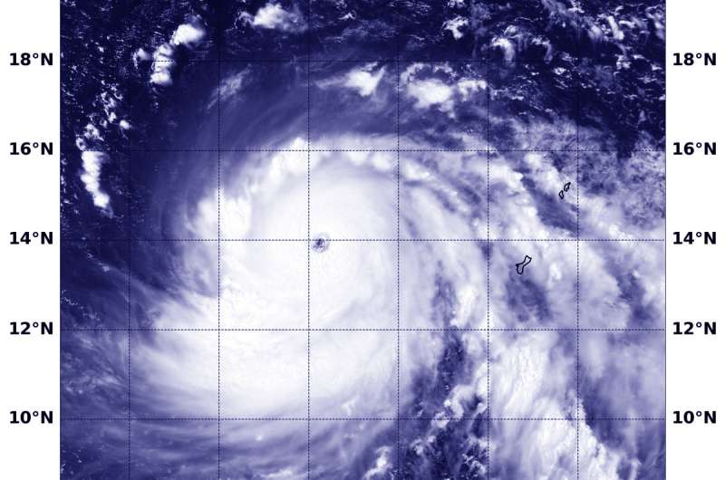
On Sept. 11 at 12:12 a.m. EDT (0412 UTC) the VIIRS instrument aboard NASA-NOAA's Suomi NPP satellite captured a visible image of Super Typhoon Mangkhut moving through the Northwestern Pacific Ocean. Credit: NOAA/NASA/NRL
Typhoon Mangkhut had already strengthened into a Super Typhoon when NASA-NOAA's Suomi NPP satellite grabbed a visible image of the storm in the Northwestern Pacific Ocean on Sept. 11. It is forecast to intensify even more.
Fortunately, Mangkhut has moved away from the Marianas Islands and is moving over open ocean so there are no watches or warnings in effect.
On Sept. 11 at 12:12 a.m. EDT (0412 UTC) the Visible Infrared Imaging Radiometer Suite (VIIRS) instrument aboard NASA-NOAA's Suomi NPP satellite captured visible image of Super Typhoon Mangkhut. The image showed a clear eye surrounded by bands of powerful thunderstorms.
At 5 a.m. EDT (7 p.m. CHST/0900 UTC) on Sept. 11, the eye of Super Typhoon Mangkhut was located near latitude 14.0 degrees north and longitude 139.1 degrees east. That's about 380 miles west of Guam. Mangkhut is moving west at 17 mph. This westward motion is expected to continue tonight, followed by a turn to the west-northwest on Wednesday and Thursday, bringing Mangkhut near northern Luzon Friday evening.
The National Weather Service in Tiyan, Guam noted that "Maximum sustained winds have increased to 155 mph, making Mangkhut a Category 4 super typhoon. Mangkhut is expected to intensify into a Category 5 super typhoon Wednesday and Thursday."
Typhoon force winds extend up to 65 miles from the center. Tropical storm force winds extend up to 205 miles northeast of the center and up to 165 miles to the southwest.
Provided by NASA's Goddard Space Flight Center


