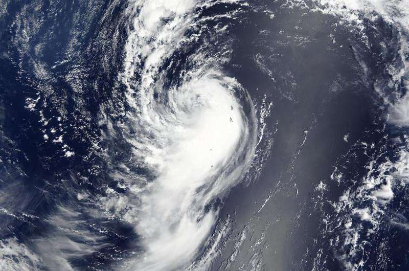
On August 9 at 01:20 UTC (Aug. 8 at 9:20 p.m. EDT), NASA's Terra satellite captured a visible-light image of Tropical Depression Molave winding down about 400 miles away from Yokosuka, Japan. Credit: NASA Goddard MODIS Rapid Response, Jeff Schmaltz
NASA's Terra satellite and the RapidScat instrument both captured data on Tropical Depression Molave as it was spinning down in the Northwestern Pacific Ocean.
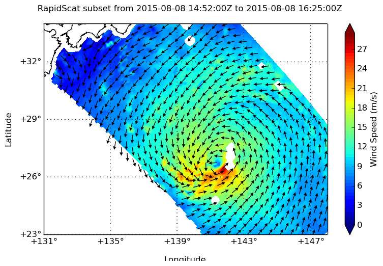
RapidScat is a NASA instrument that flies aboard the International Space Station and can measure sustained winds over an ocean surface. On August 8 at 4 p.m. UTC (12 a.m. EDT) RapidScat saw strongest sustained winds in Molave's southeastern quadrant where wind speeds were near 24 meters per second (53.6 mph/86.4 kph), tropical-storm strength. Since then, those winds have weakened.
On August 9 at 01:20 UTC (Aug. 8 at 9:20 p.m. EDT), the MODIS instrument aboard NASA's Terra satellite captured a visible-light image of Tropical Depression Molave winding down about 400 miles away from Yokosuka, Japan. The image showed a western quadrant devoid of clouds as vertical wind shear was pushing thunderstorms south and east of the center.
Two NASA centers created these images. The RapidScat image was created at NASA's Jet Propulsion Laboratory in Pasadena, California where the instrument is managed. The MODIS image was created by the NASA Goddard MODIS Rapid Response Team at NASA's Goddard Space Flight Center.
The Joint Typhoon Warning Center (JTWC) issued its final bulletin on Molave on August 9 at 1500 UTC (11 a.m. EDT). At that time, Molave had become a sub-tropical cyclone. It was centered near 28.6 North latitude and 140.6 East longitude, about 405 nautical miles (469.5 miles/755.6 km) south of Yokosuka, Japan. Molave was moving to the north at 8 knots (9.2 mph/14.8 kph) and had maximum sustained winds near 25 knots 28.7 mph/46.3 kph).
On August 8 at 12 a.m. EDT RapidScat saw strongest sustained winds in Molave's southeastern quadrant where wind speeds were near 24 meters per second (53.6 mph/86.4 kph), tropical-storm strength. Credit: NASA JPL/Doug Tyler
By August 10 at 1500 UTC (11 a.m. EDT), the remnants of Molave were centered about 287 nautical miles (330.3 miles/531.5 km) south-southeast of Tokyo, Japan, near 31.0 North latitude and 141.2 East longitude. JTWC noted that the low pressure area remains well-defined, but has scattered thunderstorms and clouds pushed to the northeast of the center by wind shear. Precipitable water imagery shows cool dry air wrapping into the system from the south which will further help prevent thunderstorms from forming.
As NASA satellites and instruments continue to eye the low pressure area, the potential for Molave to re-develop in the next day is low.
Provided by NASA's Goddard Space Flight Center


