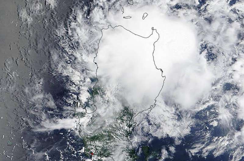
NASA sees Tropical Cyclone 12W grow into a Tropical Storm

Tropical Depression 12W (12W) formed on July 23 in the Philippine Sea, near the northeastern tip of the Luzon region of the Philippines. The storm intensified into a tropical storm as NASA's Terra satellite passed overhead at 03:00 UTC (July 22 at 11 p.m. EDT). The Moderate Resolution Imaging Spectroradiometer (MODIS) instrument aboard Terra captured a visible image of the storm that revealed the storm had become more organized with better circulation. Although bands of thunderstorms were not apparent, the storm appeared more circular on the MODIS image. The image was created at NASA's Goddard Space Flight Center in Greenbelt, Maryland, home of the MODIS Rapid Response Team.
At 1500 UTC (11 a.m. EDT) on July 24, 2015, 12W's maximum sustained winds had increased to 40 knots (46 mph/74 kph). 12W is moving slowly at 5 knots (5.7 mph/9.2 kph). It was centered near 17.7 North latitude and 124.6 East longitude, about 270 nautical miles (310.7 miles/500 km) north-northeast of Manila, Philippines.
Tropical Storm 12W is forecast to turn to the north and weaken to a depression, weakening under the influence of powerful Typhoon Halola to the northeast.
Provided by NASA's Goddard Space Flight Center


