Tropical Cyclone Raquel triggers warnings in Solomon Islands

NASA's Terra satellite and RapidScat instrument showed a slowly developing Tropical Storm Raquel affecting the Solomon Islands on June 30 and July 1. A tropical cyclone warning was in effect for all provinces of the Solomon Islands on July 1.
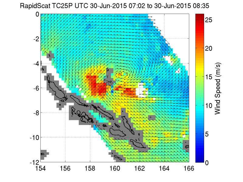
The RapidScat instrument that flies aboard the International Space Station measures surface winds. When it passed over former Tropical Depression 25P (now Raquel) it gathered data on sustained winds on June 30 from 7:02 to 8:35 UTC (3:02 to 4:35 a.m. EDT). The RapidScat data showed the strongest sustained winds were near 25 meters per second (55.9 mph/90 kph) in the western and southern quadrants of the storm.
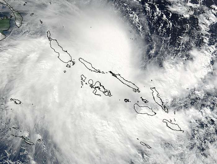
NASA's Terra satellite passed over Tropical Depression 25P on June 30 at 23:45 UTC (7:35 p.m. EDT) before it strengthened into Tropical Storm Rachel (early on July 1). The Moderate Resolution Imaging Spectroradiometer or MODIS instrument took a visible-light picture of the storm that showed an elongated center of circulation. The MODIS image also showed the storm located in the Southern Pacific Ocean, and blanketing the Solomon Islands and stretching over the Solomon Sea.
At 0900 UTC (5 a.m. EDT) on July 1, Tropical cyclone Raquel had maximum sustained winds near 45 knots (51.7 mph/83.3 kph). It was centered near 6.5 South Latitude and 159.0 East longitude, about 85 nautical miles (7.8 miles/157.4 km) northeast of Isabel Island, Solomon Islands. Rachel was moving to the west-southwest at 4 knots (4.6 mph/7.4 kph).
On July 1, the Joint Typhoon Warning Center (JTWC) said that animated mult0-spectral imagery showed tightly curved banding wrapping into a consolidating low-level center of circulation. A microwave image showed that the bulk of the strongest convection and thunderstorms were pushed southeast of the center from northwesterly wind shear.

The JTWC forecast calls for Raquel to move southwest through the Solomon Islands and intensify to 60 knots (69 mph/111 kph). A weakening trend is then expected to begin after 2 or three days as it moves into the Solomon Sea.
Provided by NASA's Goddard Space Flight Center


