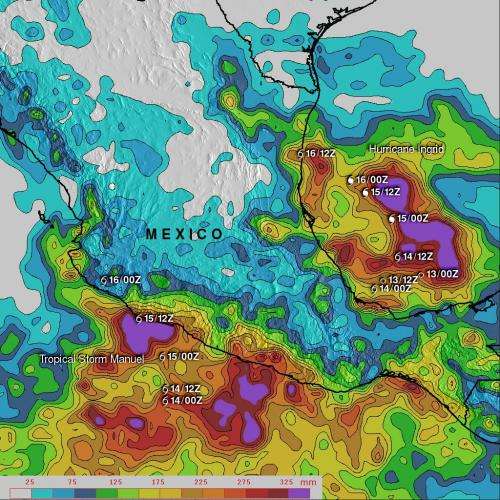
This color-coded map shows TRMM-derived rainfall totals of Tropical Storm Manuel. The heaviest rainfall totals appear in pink, where those areas received over 350mm (~14 inches) along the Pacific coast. Credit: NASA/SSAI, Hal Pierce
Tropical Storm Manuel dropped very heavy rains that caused floods and mudslides and took lives on Mexico's Pacific coast. Manuel's rainfall was captured and tallied from NASA's Tropical Rainfall Measuring Mission satellite known as TRMM.
Tropical storm Manuel may have dissipated, but the storm dropped very heavy rainfall along Mexico's Pacific coast where 21 people have been reported killed due to flooding and landslides caused by extreme rainfall. At the same time, on Sept. 16, Hurricane Ingrid weakened to a tropical storm and came ashore from the Gulf of Mexico into the state of Tamaulipas near La Pesca, Mexico, soaking that side of the country.
A TRMM-based, near-real time Multi- satellite Precipitation Analysis (MPA) created at the NASA Goddard Space Flight Center in Greenbelt, Md. is used to monitor rainfall over the global tropics. MPA rainfall totals were created for eastern Mexico for the period of September 9 through 16, 2013 when Manuel was dropping heavy rainfall along Mexico's Pacific coast. The TRMM data showed that the highest rainfall totals for tropical storm Manuel of over 350mm (~14 inches) occurred along the Pacific coast.
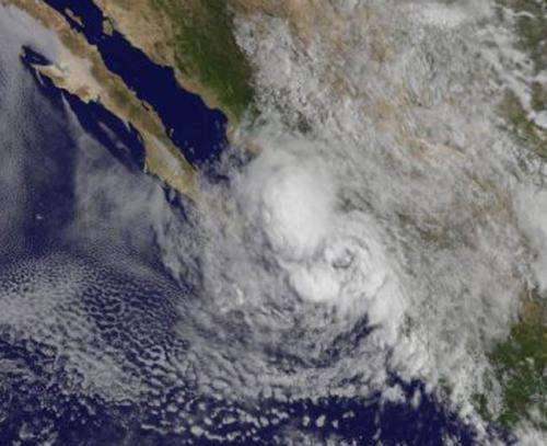
This visible image from NOAA's GOES-West satellite shows the remnants of Tropical Storm Manuel moving along the Pacific coast of Mexico. Credit: NASA GOES Project
According to reports from the Associated Press, Tropical Storm Manuel's rains flooded streets and the airport in Acapulco, forcing it to close down. Highways were also cut off from landslides.
Provided by NASA's Goddard Space Flight Center


