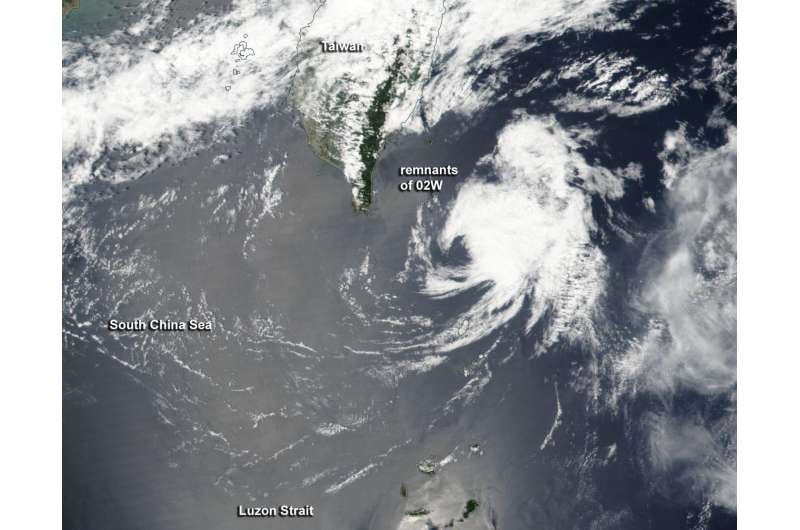
On April 20, NOAA-NASA's Suomi NPP satellite saw the remnants of Tropical Cyclone 02W as it moved through the Luzon Strait. Credit: NASA/NOAA
NASA-NOAA's Suomi NPP satellite spotted the remnants of Tropical Cyclone 02W southeast of Taiwan in the Northwestern Pacific Ocean as the system was dissipating.
On April 19, 2017 at 0600 UTC (2 a.m. EST), the Joint Typhoon Warning Center noted that former Tropical Cyclone 02W was no longer suspect for tropical cyclone formation. The low pressure area had moved into an area of strong vertical wind shear, just southeast of Taiwan and was being torn apart.
The Visible Infrared Imaging Radiometer Suite (VIIRS) instrument aboard NOAA-NASA's Suomi NPP satellite captured a visible image of the remnants after the system moved north-northeast of the northern Philippines and through the Luzon Strait. The VIIRS image showed that strong wind shear had pushed the bulk of clouds and showers east-northeast of what was left of the center of circulation. The strong vertical wind shear took its toll on the system and the remnants dissipated southeast of Taiwan.
Provided by NASA's Goddard Space Flight Center


