NASA sees wind shear's effects on Tropical Cyclone Yvette

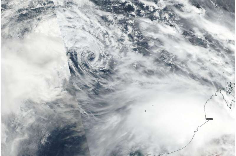
Tropical Storm Yvette was being battered by vertical wind shear when NASA-NOAA's Suomi NPP satellite passed over the Southern Indian Ocean.
On Dec. 23 the Visible Infrared Imaging Radiometer Suite (VIIRS) instrument aboard NASA-NOAA's Suomi NPP satellite provided a visible-light image of Tropical Cyclone Yvette that showed the bulk of clouds and thunderstorms were being pushed north and west of the center from vertical wind shear. The Joint Typhoon Warning Center noted that satellite imagery showed a fully-exposed, well-defined low-level circulation center displaced east of isolated, flaring convection and developing thunderstorms.
On Dec. 23 at 4 a.m. EST (0900 GMT) Yvette's maximum sustained winds had decreased to 40 mph (35 knots/64.2 kph). It was centered near 14.7 degrees south latitude and 116.2 degrees east longitude, about 365 nautical miles northwest of Port Hedland, Australia. Yvette was moving east-southeast at 10.3 mph (9 knots/16.6 kph).
For forecast updates from Australia's Bureau of Meteorology, visit: http://www.bom.gov.au/cyclone/index.shtml.
The storm will accelerate and make landfall on Christmas Day (GMT) south of Broome, Western Australia.
Provided by NASA's Goddard Space Flight Center


