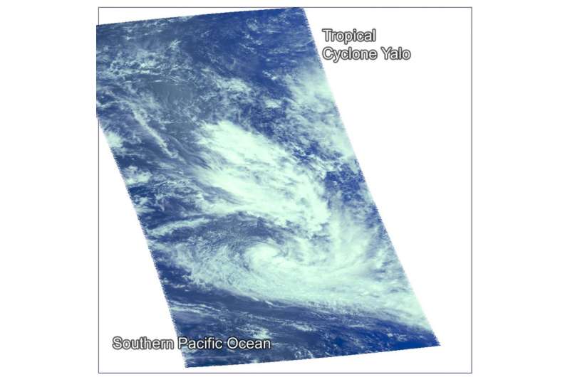
On Feb. 24 at 0005 UTC (Feb. 23 at 7:07 p.m. EST) the AIRS instrument aboard NASA's Aqua satellite captured this near-visible image of newborn storm Yalo near French Polynesia in the Southern Pacific Ocean. Credit: NASA JPL/Ed Olsen
The fourteenth tropical cyclone in the Southern Pacific Ocean developed as NASA's Aqua satellite passed overhead. The AIRS instrument aboard Aqua captured infrared, near-visible and microwave data on Tropical Cyclone Yalo early on Feb. 25.
Tropical cyclone Yalo formed at 0300 UTC on Feb. 25 (10 p.m. EST on Feb. 24). By 1500 UTC (10 a.m. EST on Feb. 25 Yalo was located about 334 nautical miles (384.4 miles/618.6 km) west-southwest of Papeete, Tahiti near 19.9 degrees south latitude and 145.9 degrees west longitude. Yalo's maximum sustained winds were near 50 knots (57.5 mph/92.6 kph) and it is forecast to intensify slightly before running into adverse conditions. Yalo was moving to the southeast at 8 knots (9.2 mph/14.8 kph).
The Atmospheric Infrared Sounder or AIRS instrument that flies aboard NASA's Aqua satellite provided near-visible and infrared temperature data on the system on Feb. 24 at 0005 UTC (Feb. 23 at 7:07 p.m. EST). AIRS revealed thunderstorms around the center of circulation where cloud top temperatures were as cold as minus 63 Fahrenheit/ minus 53 Celsius. Both near-visible and infrared imagery also showed a large, shallow band of thunderstorms east of the center.
Joint Typhoon Warning Center (JTWC) said animated enhanced infrared satellite imagery depicts shallow convective banding wrapping into a circulation center that has become increasingly symmetric between 0900 and 1500 UTC (4 a.m. and 10 a.m. EST) on Feb. 25.
The storm threatens French Polynesia and Austral Islands. Various warnings and watches have been posted on Meteo France's website: http://www.meteo.pf/vigilance.php?1061061496#bulvigi
JTWC forecasters expect Yalo will move southeast as it rides along the western boundary of a subtropical ridge (elongated area of high pressure) located to the east of the storm. By Feb. 27, the storm is forecast to move over cooler sea surface temperatures and encounter increasing vertical wind shear, which are expected to rapidly weaken it.
Provided by NASA's Goddard Space Flight Center


