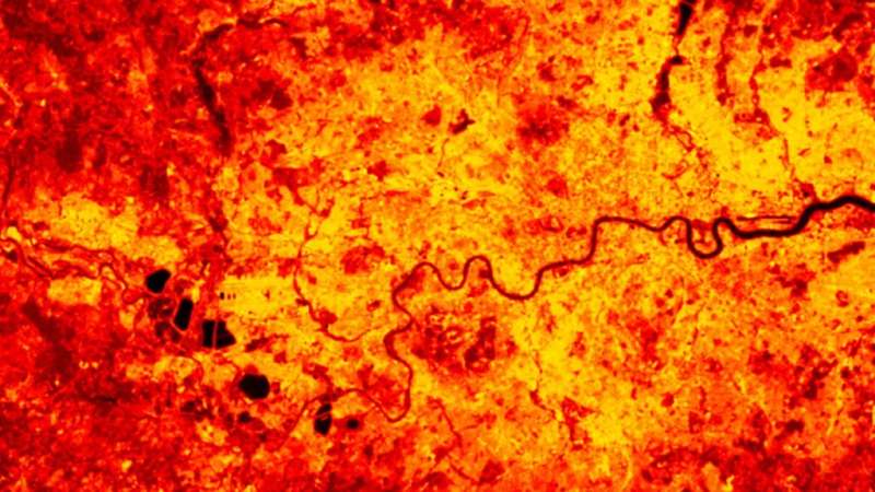
Landsat observed land surface temperature over London on 7 July 2020. The River Thames and several water reservoirs are much cooler than the surrounding land and appear darker, whereas London is much hotter and appears much brighter than the surrounding suburbs, a consequence of the surface urban heat island effect. Credit: NCEO-Leicester
Changes in near-surface air temperatures around the world are one of the most important indicators of climate change. But to fully capture the impact rising temperatures have on people, plants, and processes at Earth's surface, climate scientists and models must consider the temperature of the land itself as well.
Land surface temperature—literally, how warm or cool Earth is to the touch—is important because it affects almost every process at Earth's surface from evaporation to human health. Land surface temperature is distinct from near-surface air temperature, which is typically measured by weather stations 2 meters above the ground, but the two usually track each other quite closely.
With global coverage of temperature from both microwave and infrared data, satellites can help fill in gaps in near-surface air temperature data where weather stations aren't available, such as Antarctica and the Tibetan Plateau. The data are also valuable in their own right: Land surface temperatures are used to map urban heat islands and heat disparities, check the accuracy of climate models, and assess drought severity.
However, land and air temperature measurements don't always track each other as accurately as usual, so scientists need to check them carefully before they use them to study the climate. To determine which land surface temperature (LST) satellite data sets are the most reliable, Good et al. completed the first assessment of six different land surface temperature data sets from the European Space Agency's Climate Change Initiative for LST project.
The researchers compared those data to near-surface air temperature data to check for mismatches and looked for inconsistencies, for example, after satellite sensors were changed.
The team found that the six satellite-based land surface temperature data sets generally show similar variability to near-surface temperatures from weather stations, but satellites with microwave-based sensing slightly outperformed infrared-based sensing.
Among the six data sets, MODIS (Moderate Resolution Imaging Spectroradiometer)/Aqua and Advanced Along-Track Scanning Radiometer—both infrared data sets—most reliably tracked temporal changes in near-surface air temperatures, suggesting they are currently the best candidates for long-term temperature monitoring and trend detection. The others suffered from stability problems that resulted in jumps and disconnections from the near-surface air temperature data.
Together, the findings point to the importance that long-term, satellite-based records for land surface temperature can have for understanding changes to Earth's climate while highlighting the need for careful consideration of any data set's consistency over time.
The research was published in Earth and Space Science.
More information: E. J. Good et al, An Analysis of the Stability and Trends in the LST_cci Land Surface Temperature Datasets Over Europe, Earth and Space Science (2022). DOI: 10.1029/2022EA002317
Journal information: Earth and Space Science
Provided by American Geophysical Union
This story is republished courtesy of Eos, hosted by the American Geophysical Union. Read the original story here.


