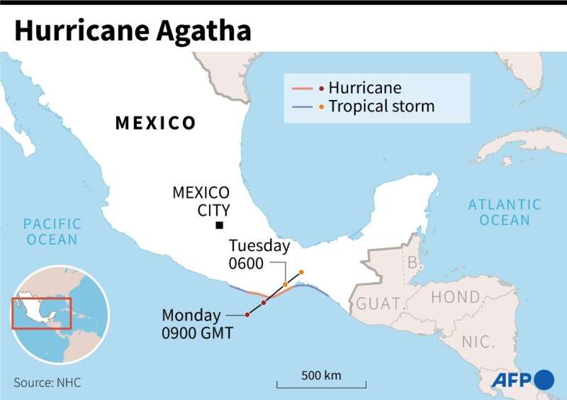
Map of Mexico showing forecast path of Hurricane Agatha.
The first hurricane of the East Pacific season on Monday barreled towards a string of beach resorts in southwest Mexico, where authorities opened shelters for thousands of people in its projected path.
At 1500 GMT, Hurricane Agatha was located 80 kilometers (50 miles) southwest of Puerto Angel in Oaxaca state, packing maximum sustained winds of 175 kilometers per hour, according to the US National Hurricane Center (NHC).
The Category 2 hurricane—the second weakest on a scale of five—was expected to make landfall on Monday afternoon or evening and rapidly weaken as it moves inland, forecasters predicted.
Residents along the coast stocked up on food and water and took measures to protect their homes and businesses.
Seaports in the area closed and airlines canceled flights to an international airport in Huatulco.
A hurricane warning was in effect for a stretch of coastline including Puerto Escondido and other surf towns popular with national and foreign tourists.
"Storm surge is expected to produce extremely dangerous coastal flooding" and will be accompanied by "large and destructive waves," the NHC warned.
In Oaxaca and neighboring Chiapas state, "life-threatening flash flooding and mudslides may occur," it added.
Authorities opened around 200 storm shelters with room for up to 26,800 people, while hotels prepared to provide refuge to tourists.
"The shelters are already open and people are arriving," Roberto Castillo, a civil protection official in Huatulco, told AFP.
Mexico is buffeted by hurricanes on both its Pacific and Atlantic coasts, generally between the months of May and November.
© 2022 AFP


