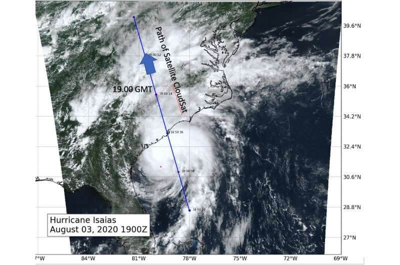
This visible image of Tropical Storm Isaias was taken from NOAA's GOES-East satellite on Aug. 3 at 3.p.m. EDT (1900 UTC) shows the path that CloudSat observed the storm. Credit: NASA
NASA's CloudSat passed over Tropical Storm Isaias as it was strengthening back into a hurricane on Aug. 3, and before it made landfall in North Carolina. CloudSat revealed areas of heavy rain and ice particles in high, powerful clouds.
Tropical Storm Isaias was going through a period of intensification from a tropical storm into a minimal hurricane as vertical wind shear weakened around the system. Wind shear is outside winds that can affect a tropical cyclone and weaken its structure or even blow it apart, if strong enough. The wind shear that had been affecting Isaias was weakening allowing the storm to intensify back into a hurricane as it did y 8 p.m. EDT on Aug. 3.
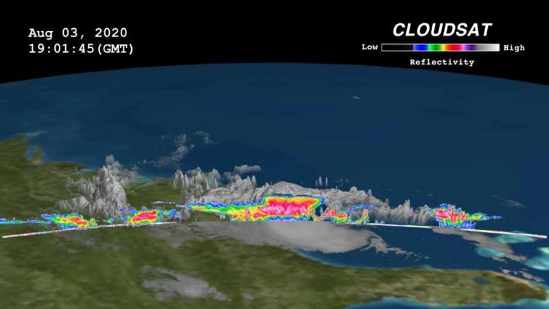
CloudSat passed east of the storm center revealing the large area of deep convection (rising air that condenses and forms the thunderstorms that make up a tropical cyclone). "The anvil of the system extended northwestward across North and South Carolina with maximum cloud heights estimated at 16-17 km (~10 to ~11 miles)," said Natalie Tourville of the Cooperative Institute for Research in the Atmosphere, Colorado State University, Fort Collins.
CloudSat also found areas of rain bands associated with Isaias in southeastern portion of the system. Those were smaller areas of convection over the Atlantic Ocean.
CloudSat is the first satellite to use an advanced cloud-profiling radar to "slice" through clouds to see their vertical structure, providing a completely new observational capability from space. The mission furnishes data that evaluate and improve the way clouds and precipitation are represented in global models, contributing to better predictions of clouds and their role in climate change.
On Aug. 3, 2020 at 3:01 p.m. EDT (1901 UTC) NASA's CloudSat satellite provided a sideways view of Tropical Storm Isaias. CloudSat found a large area of deep convection (denoted by the red and pink colors). The shades of blue and green colors in the CloudSat imagery denote smaller particles of water/ice. Credit: NASA/Colorado State
Provided by NASA's Goddard Space Flight Center


