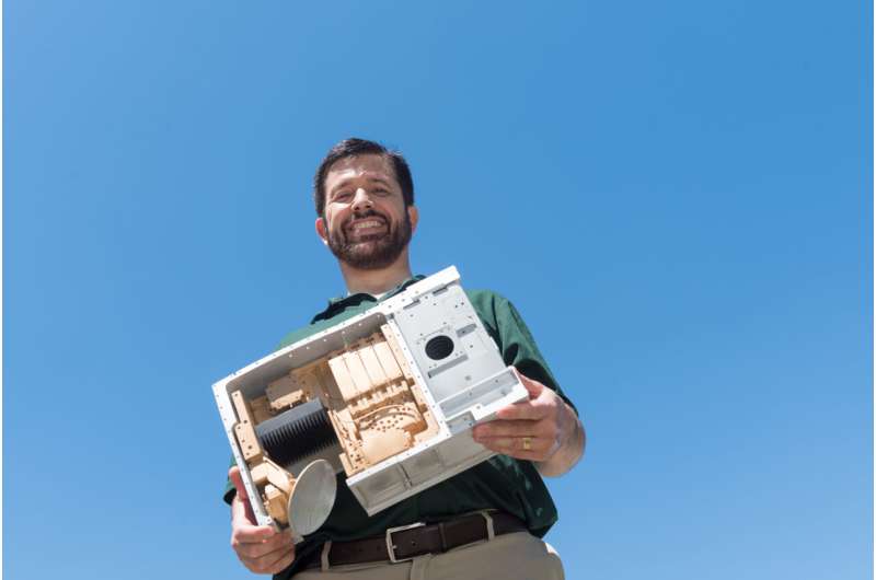
Steven Reising, professor of electrical and computer engineering, holds a model of the TEMPEST-D satellite. Credit: Bill Cotton.
After meeting all its benchmarks for demonstrating small-satellite weather forecasting capabilities during its first 90 days, a Colorado State University experimental satellite is operating after more than one year in low-Earth orbit.
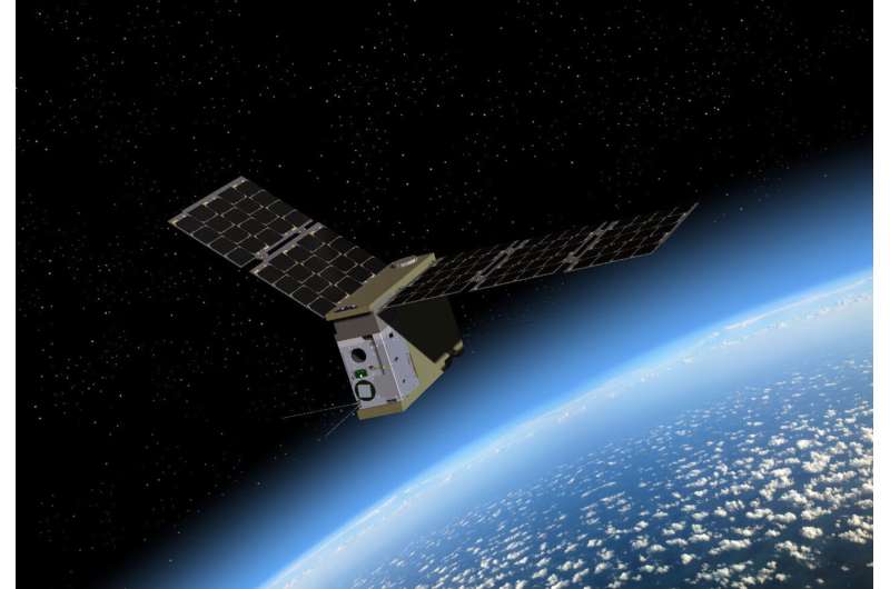
TEMPEST-D (Temporal Experiment for Storms and Tropical Systems—Demonstration), a type of small satellite called a 6U CubeSat, is still providing precise images of global weather—exceeding the expectations of even its engineers.
TEMPEST-D is about the size of an Oxford dictionary and was deployed from the International Space Station last July carrying a miniaturized microwave radiometer. Measuring at five frequencies, TEMPEST-D can see through clouds to reveal the interior of storms where raindrops and ice crystals form.
The project is led by principal investigator Steven Reising, professor of electrical and computer engineering, whose team developed the satellite supported by an $8.2 million grant from NASA's Earth Science Technology Office.
"TEMPEST-D is the first weather satellite on a CubeSat to image the interior of storms on a global basis," said Reising, who heads the project in collaboration with co-investigator V. "Chandra" Chandrasekar, University Distinguished Professor in electrical and computer engineering. "We have shown that the quality of our data is at least as high as that from large operational radiometers in orbit."
Artist’s rendering of the deployed TEMPEST-D satellite. Credit: Blue Canyon Technologies, CSU
Chandra is a veteran of multiple large weather satellite missions.
"This mission has been wildly successful—beyond our dreams," he said. "It was just supposed to demonstrate the technology of the radiometer and orbital maneuvers. Then it started taking data, and people were saying, "Wow!"… It's looking at hurricanes and producing very high-quality global data—very much like a big mission."
Demonstrating future technologies
TEMPEST-D is intended as a proof-of-concept for next-generation Earth-observing technologies that are orders of magnitude smaller and lower cost than traditional satellites operated by federal agencies.
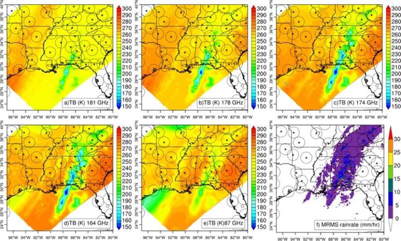
TEMPEST-D data from Jan. 29, 2019, shows a storm in the southeastern U.S., with ground-based weather radar rainfall estimates in the lower right panel. The areas covered by each radar are represented by circles. Credit: V. Chandrasekar
The ultimate goal is to send not just one but a constellation of six to eight CubeSats like TEMPEST-D into space. The satellites would fly in a train, watching storms develop every few minutes. Such fine temporal resolution would offer unprecedented views inside storms—such as those that threaten the Atlantic Basin and the eastern U.S. every year—to monitor how they develop every few minutes over a 30-minute period. Such a mission could also improve scientists' understanding of cloud processes and the influence of surrounding water vapor.
Christian Kummerow, director of CSU's Cooperative Institute for Research in the Atmosphere, is also a co-investigator on TEMPEST-D. He worked with Reising to develop new techniques to retrieve cloud and precipitation information of interest to atmospheric scientists.
NASA mission
TEMPEST-D is led by CSU and managed by NASA's Jet Propulsion Laboratory (JPL) in Pasadena, California, in partnership with Boulder-based Blue Canyon Technologies. The ground station is operated by NASA Wallops Flight Facility in Virginia. The mission is sponsored by NASA's Earth Ventures program and managed by the Earth Science Technology Office. The radiometer instrument was built by JPL and employs extremely high-frequency microwave amplifier technology developed by the Northrop Grumman Corporation.
Provided by Colorado State University


