Credit: NOAA
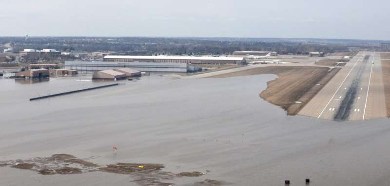
The so-called bomb cyclone that brought heavy snow, blizzard conditions and major flooding to the Midwest in March landed with a resounding meteorological "ka-boom!" and became one of two billion-dollar weather and climate disasters this year.
The other was a severe storm that struck the Northeast, Southeast and Ohio Valley in late February.
And it's only April.
Here's a closer look at highlights from NOAA's latest U.S. climate report:
Climate by the numbers - March 2019
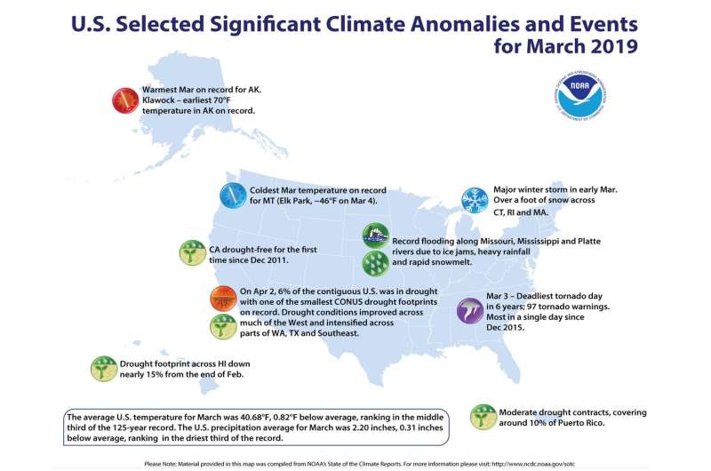
The average temperature for the contiguous U.S. during March was 40.68 degrees F (0.82 of a degree below average), ranking in the middle third of the 125-year record for the month, according to scientists at NOAA's National Centers for Environmental Information.
The total precipitation for March for the contiguous U.S. was 2.20 inches (0.31 of an inch below average), which fell within the driest third of the 125-year period of record.
Year to date - January through March 2019
The average U.S. temperature for the year to date (January through March) was 35.03 degrees F (0.12 of a degree F below average), which landed among the middle third of the record. This was the coldest start to a year since 2014.
The total precipitation was 8.03 inches (1.07 inches above average), tying with 1949 as 12th wettest YTD on record.
An annotated map of the United States showing notable climate events that occurred across the country during March 2019. Credit: NOAA NCEI
Other noteworthy highlights
- A baked Alaska: Last month's temperatures in Alaska were 15.9 degrees F above average, making it the hottest March for the state in the 95-year record.
- Drought improved: At the end of March, about 6 percent of the contiguous U.S. was in drought, down from 12 percent at the end of February.
More information: Assessing the U.S. Climate in March 2019: www.ncei.noaa.gov/news/national-climate-201903
Provided by NOAA Headquarters


