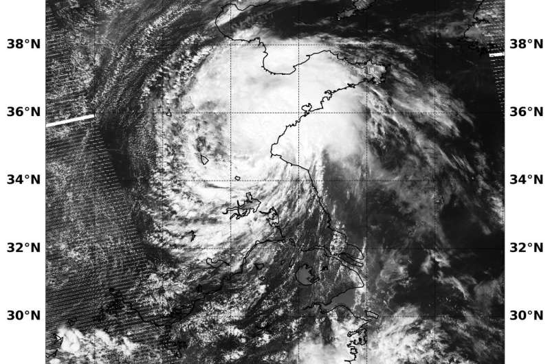
On July 23 at 12:54 a.m. EDT (0454 UTC) the VIIRS instrument aboard NASA-NOAA's Suomi NPP satellite captured a visible image of Tropical Cyclone Ampil inland over eastern China. Credit: NOAA/NASA Goddard Rapid Response Team
NASA-NOAA's Suomi NPP satellite passed over the Northwestern Pacific Ocean and captured a visible image of Tropical Depression Ampil moving over land in eastern China.
On July 23 at 12:54 a.m. EDT (0454 UTC) the Visible Infrared Imaging Radiometer Suite (VIIRS) instrument aboard NASA-NOAA's Suomi NPP satellite captured visible image of Ampil over Shandong, an eastern Chinese province on the Yellow Sea. The VIIRS image showed Ampil's center was located over land. The VIIRS image showed the most powerful band of thunderstorms wrapping into the low-level center from the east and the Yellow Sea.
On July 2 at 11 a.m. EDT (1500 UTC) Ampil's center was located near 37.1 degrees north latitude and 118.2 degrees east longitude. That's approximately 407 nautical miles west on Inchon, South Korea. Ampil was moving to the north at 17 mph (15 knots/27.7 kph). Maximum sustained winds were near 28.7 mph (25 mph/46.3 kph).
The Joint Typhoon Warning Center or JTWC forecast said Ampil is moving northwest over eastern China and will briefly move back in over waters of the Bohai Bay. The storm is then forecast to track back over land and dissipate in the next couple of days.
Provided by NASA's Goddard Space Flight Center


