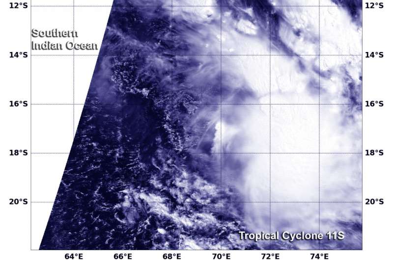
NASA's Terra satellite captured this visible image of Tropical Cyclone 11S on March 10 at 0515 UTC (12:15 a.m. EST). Credit: NASA/NRL
Tropical Cyclone 11S appeared elongated in NASA satellite imagery as a result of the storm being battered by wind shear.
When NASA's Terra satellite flew over Tropical Cyclone 11S on March 10 at 0515 UTC (12:15 a.m. EST) the Moderate Resolution Imaging Spectroradiometer or MODIS instrument took a visible light picture of the storm. The image revealed that the storm has been stretched out by moderate vertical wind shear.
The Joint Typhoon Warning Center (JTWC) in Pearl Harbor, Hawaii noted "Animated multispectral satellite Imagery shows a system with a weak and ragged low level circulation that is partially exposed and sheared from the main convection. The low-level center of circulation has become elongated and obscured."
At 0900 UTC (4 a.m. EST) on March 10, Tropical Cyclone 11S has maximum sustained winds near 35 knots (40 mph/62 kph). The tropical storm was moving to the south at 14 knots (16.1 mph/25.9 kph). It was centered near 16.6 degrees south latitude and 69.3 degrees east longitude, about 715 nautical miles (822.8 miles/1,324 km) east-northeast of Mauritius.
The JTWC expects Tropical Storm 11S to move southwestward and gradually intensify as vertical wind shear eases. The storm is expected to strengthen to 60 knots (69.5 mph/111.1 kph) in four days before it runs into an area of stronger vertical wind shear and cooler sea surface temperatures that will weaken the storm.
Provided by NASA's Goddard Space Flight Center


