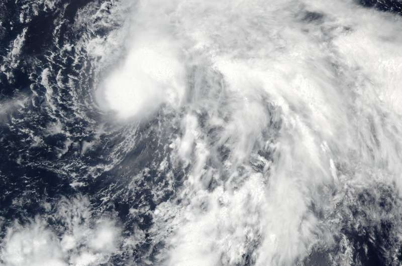
On Aug. 9 at 10:25 p.m. EDT (Aug. 10 at 02:25 UTC) the VIIRS instrument aboard NASA-NOAA's Suomi NPP satellite captured this visible-light image of Tropical Storm Conson. Credit: NASA/NOAA/Rapid Response Team
NASA-NOAA's Suomi NPP satellite passed over Tropical Storm Conson early on Aug. 10 and visible imagery showed the wind shear that was affecting the storm earlier has waned as the system appeared more rounded.
On Aug. 9 at 10:25 p.m. EDT (Aug. 10 at 02:25 UTC) the Visible Infrared Imaging Radiometer Suite (VIIRS) instrument aboard NASA-NOAA's Suomi NPP satellite captured a visible light image of Tropical Storm Conson. The southwesterly wind shear that had pushed the bulk of clouds and showers to the northeast of the storm's center on Aug. 8 has weakened. Although still appearing somewhat elongated, the clouds and thunderstorms were wrapping around the center of circulation. Fragmented bands of thunderstorms from the east were seen wrapping into the low-level center of circulation.
At 5 a.m. EDT (0900 UTC) on Aug. 10, 2016, Tropical Storm Conson was centered near 18.5 degrees north latitude and 155.5 degrees east longitude, about 352 nautical miles south-southeast of Marcus Island, also known as Minami-Tori-shima. It is an isolated Japanese coral atoll about 1,148 miles (1,848 kilometers) southeast of Tokyo.
Conson was moving to the west at 6.9 mph (6 knots/11.1 kph) and had maximum sustained winds near 51.7 mph (45 knots/83.3 kph).
The Joint Typhoon Warning Center (JTWC) forecast calls for Conson to strengthen as it continues north over the next several days. Conson is expected to reach typhoon status on Aug. 12, far away from land areas in the Northwestern Pacific Ocean.
Provided by NASA's Goddard Space Flight Center


