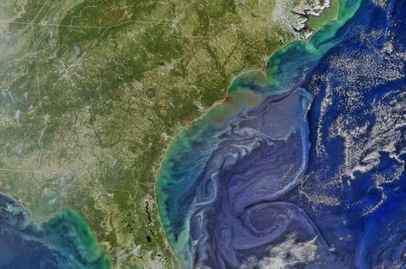
Credit: NASA/Goddard/SuomiNPP/VIIRS via NASA's OceanColor
Damaging heavy rains fell on South Carolina in the southeastern United States at the beginning of October 2015. Much of that water had, by mid-October, flowed into the Atlantic Ocean bringing with it heavy loads of sediment, nutrients, and dissolved organic material.
The above image, from the Visible Infrared Imaging Radiometer Suite (VIIRS) instrument on NASA-NOAA's Suomi NPP satellite, shows the runoff as it interacts with ocean currents on Oct. 15.
Suomi NPP, launched on Oct. 28, 2011, represents a critical first step in building the next-generation Earth-observing satellite system that will collect data on long-term climate change and short-term weather conditions. Suomi NPP launched with five key instruments, including VIIRS, a scanning radiometer which collects visible and infrared imagery and radiometric measurements of the land, atmosphere, cryosphere, and oceans.
VIIRS data is used to measure cloud and aerosol properties, ocean color, sea and land surface temperature, ice motion and temperature, fires, and Earth's albedo. Climatologists use VIIRS data to improve our understanding of global climate change.
Provided by NASA


