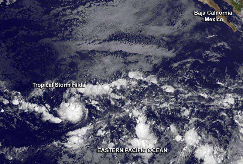
GOES-West infrared image of newborn Tropical Storm Hilda on August 6 at 1500 UTC (11 a.m. EDT). Credit: NASA/NOAA GOES Project
The GOES-West satellite captured images of Tropical Storm Hilda as it developed early on August 6.
A low pressure area organized into a depression early on August 6 and by 11 a.m. EDT (1500 UTC), it strengthened into a tropical storm and was named Hilda. In the GOES-West infrared image from1500 UTC (11 a.m. EDT), thunderstorms tightly surround the center of circulation.
The National Hurricane Center's Forecaster Kimberlain noted "The cyclone's cloud pattern has significantly increased in organization since late yesterday. There is now a small central mass of deep convection, with a band on the northern side of the circulation."
At 800 AM PDT (1500 UTC), the center of Tropical Storm Hilda was located near latitude 12.7 North, longitude 132.3 West. That puts the center of Hilda about 1,630 miles or 2,620 km west-southwest of the southern tip of Baja California, Mexico, far from land. Hilda is moving toward the west near 13 mph (20 kph). This motion is expected to continue through tonight followed by a turn toward the west-northwest on Friday. The estimated minimum central pressure is 1004 millibars.
Maximum sustained winds have increased to near 40 mph (65 kph) and strengthening is forecast during the next 48 hours, Hilda is expected to be near hurricane strength by Saturday, August 8.
Provided by NASA's Goddard Space Flight Center


