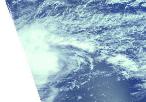
This near-infrared image of Tropical Storm Bavi was taken by the AIRS instrument aboard NASA's Aqua satellite on March 13. Credit: NASA JPL, Ed Olsen
NASA's Aqua satellite passed over Tropical Storm Bavi as it continued on a west-northwesterly track through the Northwestern Pacific Ocean. Bavi has already generated a typhoon watch for Guam, Rota, Tinian and Saipan.
The Atmospheric Infrared Sounder or AIRS instrument aboard NASA's Aqua satellite captured an image of Bavi on March 13. The image showed the eastern two-thirds of the storm and revealed strong thunderstorms around the center of circulation and a thick band of thunderstorms north of the center.
On March 13 at 1500 UTC (11 a.m. EDT), Tropical Storm Bavi had maximum sustained winds near 50 knots (57.5 mph/92.6 kph). It was centered about 851 nautical miles east-southeast of Andersen Air Force Base, Guam, near 9.7 north latitude and 128.8 east longitude. Bavi was moving to the west-northwest at 15 knots (17.2 mph/27.7 kph) and is expected to continue in that general direction.
The Joint Typhoon Warning Center (JTWC) forecast calls for Bavi to strengthen to hurricane-force on March 16 after passing over Guam on March 15. The JTWC extended forecast track calls for Bavi to move into the Philippine Sean and approach the eastern Philippines as a typhoon by March 18.
Provided by NASA's Goddard Space Flight Center


