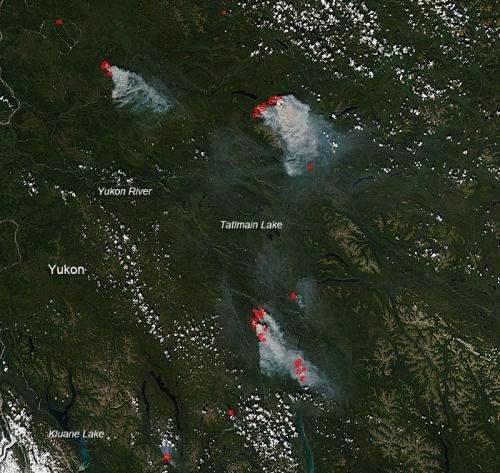
Credit: NASA image courtesy Jeff Schmaltz LANCE/EOSDIS MODIS Rapid Response Team, GSFC.
In the Yukon territory of Canada, several large wildfires continue to burn unabated. The fires on this image are located near Carmacks and also near Stewart Crossing. The Yukon Wildland Fire Management map dated July 15, 2013 shows quite a few fires in the Yukon territory with many currently uncontained. These MODIS image fires appear to be the uncontained fires noted on the map.
During this year to date the Yukon territory has seen 133,166 hectares (329, 060 acres) of land burned by fires.
NASA's Aqua satellite collected this natural-color image with the Moderate Resolution Imaging Spectroradiometer, MODIS, instrument on July 14, 2013. Actively burning areas, detected by MODIS's thermal bands, are outlined in red.
Provided by NASA's Goddard Space Flight Center


