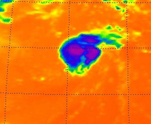
This is Tropical Storm Michael on Sept. 5 at 0611 UTC (2:11 a.m. EDT). Noticed the strongest thunderstorms and coldest cloud top temperatures (purple) around the center of circulation and in a band of thunderstorms to the northeast of the center. Credit: NASA JPL, Ed Olsen
NASA's Aqua satellite shows that tiny Tropical Storm Michael had some strong thunderstorms wrapped around its center and in a band of thunderstorms in its northeastern "arm" or quadrant.
The Atmospheric Infrared Sounder (AIRS) instrument that flies aboard NASA's Aqua satellite captured in infrared image of Tropical Storm Michael on Sept. 5 at 0611 UTC (2:11 a.m. EDT) and noticed the strongest thunderstorms and coldest cloud top temperatures around the center of circulation and in a band of thunderstorms to the northeast of Michael's center. Those cloud top temperatures were as cold as -63 Fahrenheit (-52 Celsius) and indicated strong thunderstorms with heavy rainfall.
On Sept. 5 at 11 a.m. EDT, Michael had maximum sustained winds near 50 mph (85 kmh). The area of tropical storm force winds have expanded over the last two days and now extend outward up to 60 miles (95 km). Michael's center was about 1155 miles (1,855 km) west-southwest of the Azores islands, near latitude 28.3 north and longitude 43.3 west. Michael is moving toward the northeast near 6 mph (9 kmh) and is expected to continue in that direction for the next couple of days.
The National Hurricane Center expects the wind shear that has been battering Michael over the last couple of days to relax, which may allow Michael to become a hurricane by Friday, Sept. 7.
Provided by NASA's Goddard Space Flight Center


