Credit: NASA
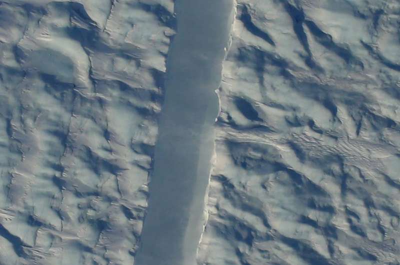
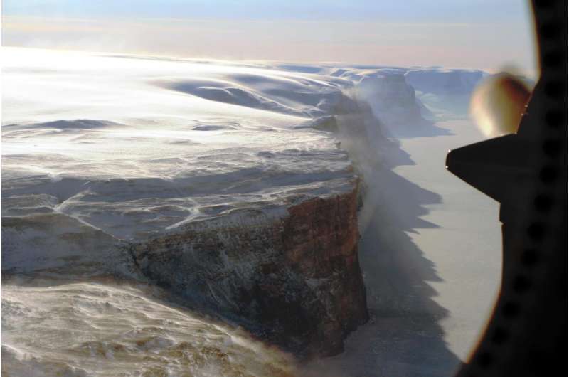
(Phys.org)—A team of researchers working with NASA's Operation IceBridge has snapped a picture of a crack in the middle part of Petermann Glacier—it resides on Greenland's northern coast. The photo and other accompanying images have been released to the media to allow the public to see what is occurring.
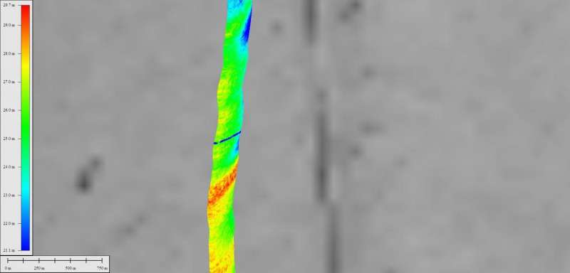
Operation IceBridge consists of flying airplanes over parts of Antarctica and Greenland and taking pictures to monitor changes in ice coverage and formations. A crew canvassing a region near Thule flew over an area identified by Stef Lhermitte, an associate professor at Delft University of Technology in the Netherlands. He discovered the crack and has been monitoring it using satellite photographs and publishing what he finds on Twitter.
The crack is clearly identifiable in the image supplied by NASA and is of particular concern because of its location. Most cracks in glaciers occur relatively close to the sea as the warmer temperatures and angle of descent cause ice to break off and float away. But this new crack is very close to the center of the glacier, which suggests some other factor is at play. Lhermitte has suggested it is likely the crack formed due to warmer water underneath the glacier, though it is not clear how it might have got there.
If the glacier does crack and a big chunk floats away (the resulting ice island would be approximately 50 to 70 square miles in size), it would not change the level of the ocean as some have claimed—the ice is already floating on the surface—but it would make room for new ice to begin flowing into the sea, which would increase the sea level a small amount.
Credit: NASA
Whether the glacier will split is still uncertain, the team at NASA notes, as there is a medial flow line between the new crack and an older one that formed on the flank—it could keep the crack from spreading.
Large chunks of glaciers falling into the sea have made news over the past several years as politicians and others use them as an example of global warming and the harm we are causing to the planet.
Credit: NASA
More information: www.facebook.com/NasaOperation … sts/1299403966803287
© 2017 Phys.org


