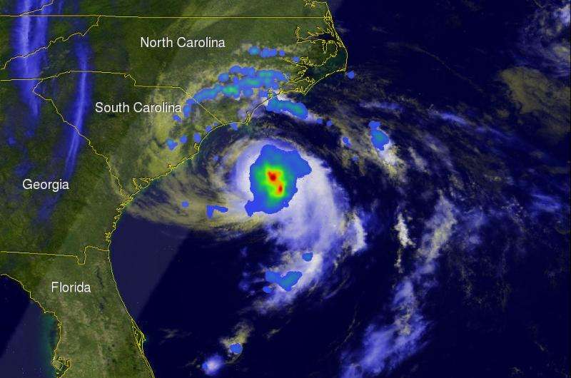
The GPM satellite flew over when ANA was making the change from subtropical storm to tropical storm. Credit: NASA/SSAI, Hal Pierce
On May 9, 2015 at 1626 UTC ( 12:26 PM EDT) the GPM satellite flew over when ANA was making the change from subtropical storm to tropical storm. Convective storms near the inner-core region were warming the center of the storm with heat generated by condensation. GPM's Microwave Imager (GMI) measured rain falling at at rate of over 58.7 (2.31 inches) per hour in these convective storms near ANA's center. The lighter swath to the west of ANA's center shows the area viewed by GPM's Ku/Ka-band Dual-frequency Precipitation Radar (DPR).
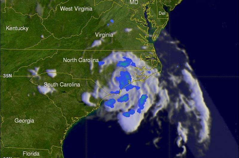
On Sunday morning (May 10, 2015) Tropical storm ANA dropped heavy rainfall as it came ashore near Myrtle Beach, South Carolina. The GPM satellite had a good look at dissipating tropical depression ANA on May 11, 2015 at 0116 UTC (May 10, 2015 9:16 PM EDT). GPM's Microwave Imager (GMI) found that ANA's rainfall intensity had greatly decreased as the dissipating tropical cyclone was moving over North Carolina toward the northeast.
Tropical storm ANA dropped heavy rainfall as it came ashore near Myrtle Beach, S.C. Credit: NASA/SSAI, Hal Pierce
Provided by NASA's Goddard Space Flight Center


