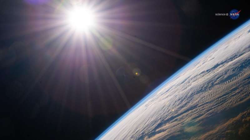
December 30, 2021—The sun shines above the Earth's horizon as the International Space Station orbited 264 miles above the Canadian province of Quebec. Credit: NASA
These pictures depict the magnificent wonders of our planet, yet, they weren't taken anywhere on Earth. Instead, they were captured by astronauts aboard the International Space Station to chronicle the fragile beauty and ever-changing landscape of our collective home.
To date, over 4 million photos taken by humans from space have been collected, from the earliest days of the Mercury and Gemini missions to the ones taken aboard the Space Station, and all are freely available to researchers, scientists and the public worldwide. These photographs are taken for many purposes, from artistic to the scientific, and have proven to have a wide range of uses.
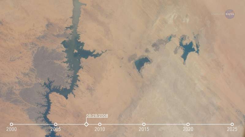
A powerful use of crew photography is to study changes to our planet over long periods of time. The Toshka Lakes & Lake Nasser in Egypt, for example, have been photographed on a regular basis from the station over the past 20 years. This is partially because the water levels in these lakes change dramatically on a month-to-month basis, constantly affecting agriculture in the region. Researchers, able to observe these bodies of water over a long period of time using crew photography, can ask: Is their volume more or less stable over time? Or, are they slowly losing their water?
Andrea Wenzel is a geoscientist for the Earth Science & Remote Sensing unit, who manage requests for crew photography. She notes the flexibility that a crew member offers when taking a picture of Earth. "A satellite generally takes the same photos over the same locations in the same orientation over and over. Astronauts on the other hand can use different lenses to take photos with different fields of view—from close up to wide shots. The Cupola on the bottom of the Space Station allows for a panoramic view straight down, or the crew member can elect to photograph an image that includes the horizon. And, because the Space Station flies an asynchronous orbit around Earth, it can capture images at any time of day or night."
Credit: NASA
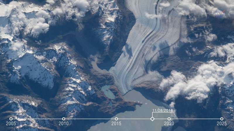
Wenzel notes that the Viedma Glacier at the southern end of South America is a good example of a moving Earth feature being observed by crew photography over time. There's been a significant decrease in the glacier's length over the years and the photos allow researchers to observe the path the glacier is taking and correlate that to climate change data.
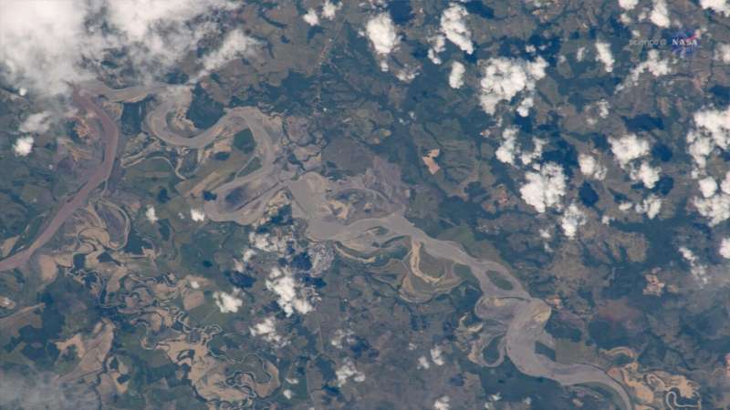
The crew can also be asked to capture an event, like a hurricane, wildfire, flood or volcanic eruption. This image shows flooding in Columbia. Wenzel says, "It was one of a series of photos that was used by international first responders to update their flood maps. As a result, they launched an operation to rescue the inhabitants of local villages who were stuck in place due to rising water"
-
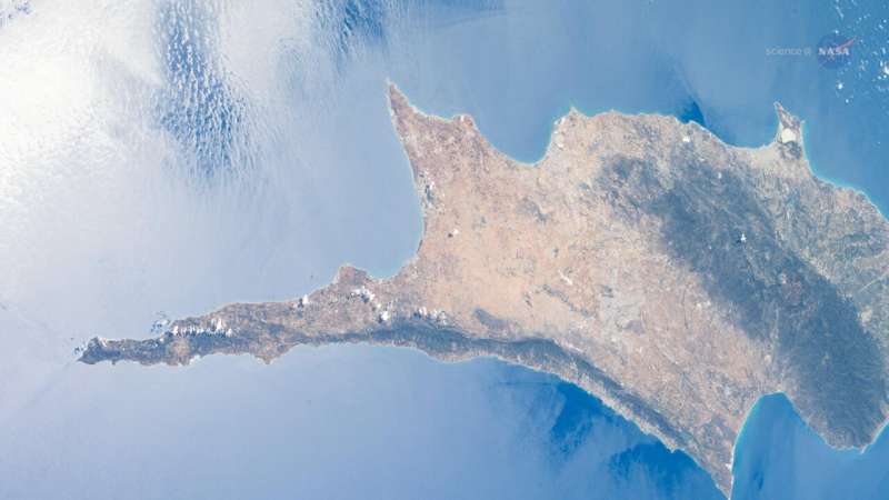
April 22, 2021 - The island of Cyprus in the eastern Mediterranean Sea is pictured from the International Space Station as it orbited 263 above Aleppo, Syria. Credit: NASA
-
August 22, 2008—Toshka Lakes, Lake Nasser in Egypt from the International Space Station. Credit: NASA
-
November 8, 2018—Viedma Glacier, Patagonia ice fields in Argentina from the International Space Station. Credit: NASA
-
July 28, 2020—Flooding in Columbia from the International Space Station. Credit: NASA
Astronauts often say the most remarkable thing about seeing Earth from the Space Station is viewing our planet across climate zones and continents, without borders drawn on a map. Fortunately for those of us still on the ground, their photographic skills allow us to see what they see—now and over decades of time—benefiting all of us in multiple ways.
Provided by NASA
