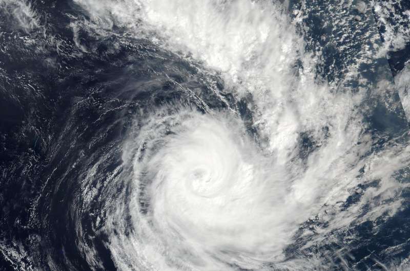
NASA sees new Tropical Cyclone Cook moving past New Caledonia

Tropical Cyclone Cook formed in the Southern Pacific Ocean and on Sunday, April 9, 2017 and moved across the island of New Caledonia in the South Pacific Ocean on early on April 10. NASA-NOAA's Suomi NPP Satellite passed over Cook as it was making landfall.
The Visible Infrared Imaging Radiometer Suite (VIIRS) instrument aboard NASA-NOAA's Suomi NPP satellite provided a visible image of Cook on April 10 at 0254 UTC (April 9 at 10:54 p.m. EST). That was about one hour before the storm's center made landfall in central New Caledonia. The image showed a cloud-filled eye surrounded by powerful thunderstorms. A large band of thunderstorms feeding into the center blanketed the islands of Vanuatu.
On April 11 at 1500 UTC (11 a.m. EST) Tropical Cyclone Cook has maximum sustained winds near 70 knots (80.5 mph/129.6 kph) making it a Category 1 hurricane on the Saffir-Simpson Hurricane wind scale. It was located just 47 nautical miles south-southwest of Noumea, New Caledonia near 23.3 degrees south latitude and 166.0 degrees east longitude. It was moving to the south at 12 knots (13.8 mph/22.2 kph).
The Joint Typhoon Warning Center or JTWC noted that animated enhanced infrared satellite imagery showed that there was a decrease in central convection and warming cloud tops over the system since it made landfall over New Caledonia around 0400 UTC (12 a.m. EST).Microwave imagery still showed that bands of thunderstorms were still wrapping into a defined center of circulation.
At 11 a.m. EST (1500 UTC) on April 10, Meteo France in New Caledonia noted that Cyclonic Alert number 2 remained in effect on April 10 for the municipalities of Thio, Bourail, La Foa, Sarraméa, Moindou and Farino, the province of the islands, the Northern Province (with the exception of the communes of Bélep and Maré which remain on cyclonic level 1 alert) . Alert # 1 was also still in effect on the rest of New Caledonia.
JTWC noted that "environmental conditions are no longer supportive of development with vertical wind shear increasing to 20 knots (23 mph/27 kph) and sea surface temperatures decreasing to 27 degrees Celsius (80.6 degrees Fahrenheit)," so it is forecast to weaken over the next two days.
Provided by NASA's Goddard Space Flight Center


