Two views of Super Typhoon Atsani from NASA's Aqua Satellite

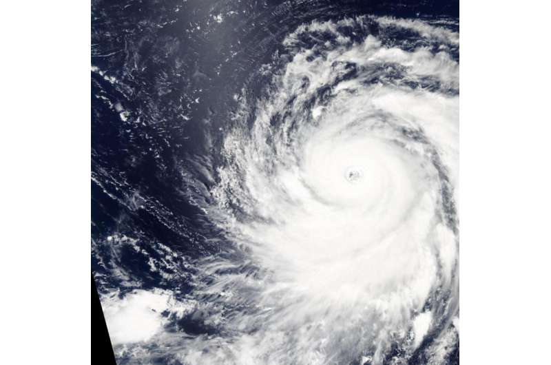
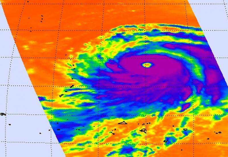
NASA's Aqua satellite passed over Super Typhoon Atsani and captured visible and infrared data on the monster storm. The AIRS and MODIS instruments gathered data that revealed powerful thunderstorms surrounding a wide-open eye.
On August 18 at 03:37 UTC (11:37 p.m. EDT, Aug. 17) the AIRS instrument aboard NASA's Aqua satellite gathered infrared data on Atsani. In a false-colored image of the data created at NASA's Jet Propulsion Laboratory in Pasadena, California, cloud top temperatures revealed cloud top temperatures as cold as 210 kelvin/-63.1F/-81.6C surrounding the eye. Cloud top temperatures that cold indicate very high, powerful thunderstorms with the capability for generating heavy rainfall.
AIRS data also showed that the sea surface temperatures around the storm were warmer than 300 kelvin (80.3 Fahrenheit/26.8 Celsius), warm enough to support the typhoon.
At the same time, the Moderate Resolution Imaging Spectroradiometer or MODIS instrument that flies aboard Aqua captured a visible picture of the storm. The MODIS image showed bands of thunderstorms wrapping into the center from the northwestern and southeastern quadrants.
On August 19, 2015 at 1500 UTC (11 a.m. EDT) Super Typhoon Atsani had maximum sustained winds near 140 knots (161.1 mph/ 259.3 kph), making it a Category 5 hurricane on the Saffir-Simpson Scale. It was centered near 19.6 North latitude and 151.3 East longitude, about 637 nautical miles (733 miles/1,180 km) east-southeast of Iwo To island, Japan. Atsani was moving to the northwest at 7 knots (8 mph/12.9 kph).

Typhoon-force winds were occurring up to 30 nautical miles (34.5 miles/55.5 km) from the center, and tropical storm-force winds were occurring up to 180 nautical miles (207 miles/333 km) from the center, making the storm about 360 nautical miles (414 miles/666.7 km) wide!
Atsani is moving northwest and forecasters at the Joint Typhoon Warning Center expect it will intensify to 145 knots by August 20. Atsani is then expected to becoming extra-tropical as it turns northeast, remaining well south of Japan.
Provided by NASA's Goddard Space Flight Center


