NASA's GPM sees Typhoon Atsani intensifying

Typhoon Atsani was an intensifying tropical storm moving over the open waters of the Pacific Ocean on August 16, 2015 when the GPM core observatory satellite flew overhead.
The Global Precipitation Measurement or GPM mission core satellite passed over Atsani at 06:01 UTC (2:01 a.m. EDT). GPM is managed by both NASA and the Japan Aerospace Exploration Agency.
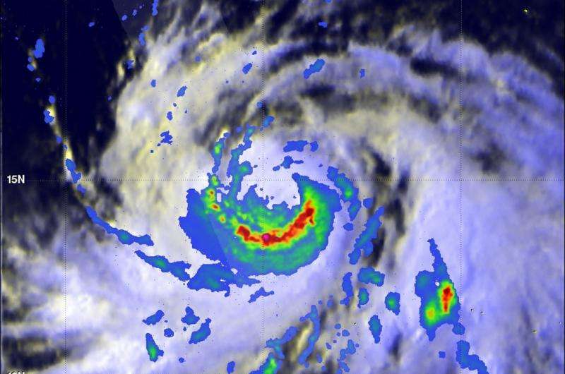
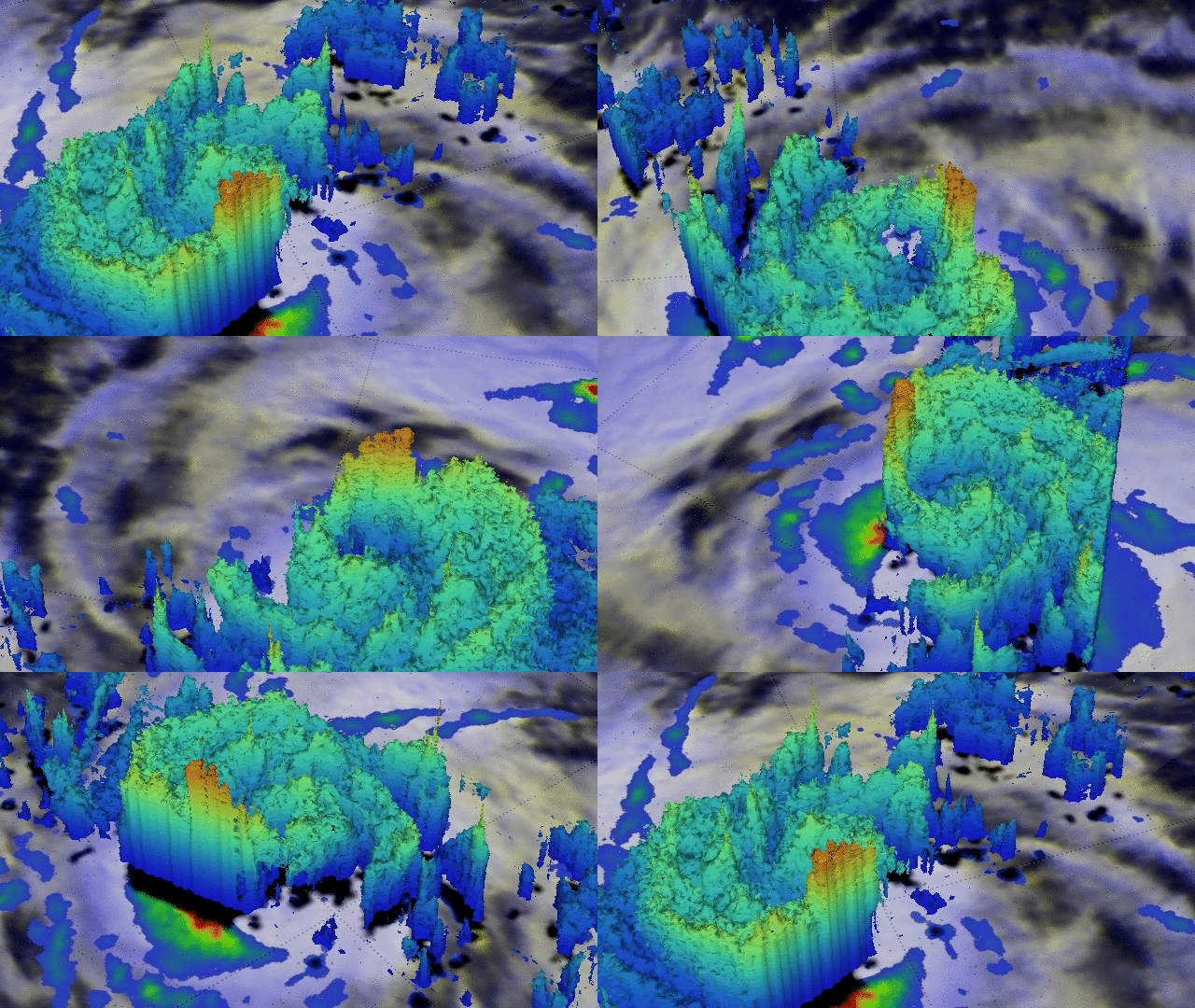
At NASA's Goddard Space Flight Center in Greenbelt, Maryland, an analysis of precipitation derived from GPM's Microwave Imager (GMI) and Dual-Frequency Precipitation Radar (DPR) instruments was overlaid on a visible image from Japan's MTSAT-2 satellite image to provide a look at the entire storm. The analysis revealed that very heavy rain that was located south of the storm's center of circulation. Rain there was found to be falling at a rate of over 90 mm (3.5 inches) per hour. A simulated 3-D view of rainfall of that area constructed at Goddard using data from GPM's Ku Band radar data. That 3-D image showed that the tops of these storms were reaching heights of 16.8 km (10.4 miles).
At 1500 UTC (11 a.m. EDT), on August 18, Typhoon Atsani had maximum sustained winds near 120 knots (138 mph/222 kph). That makes Atsani a Category Four typhoon on the Saffir-Simpson Scale. When Atsani strengthens to 130 knots (150 mph) it will be classified as a super-typhoon.
"Super-typhoon" is a term utilized by the U.S. Joint Typhoon Warning Center for typhoons that reach maximum sustained 1-minute surface winds of at least 65 meters per second (130 knots/150 mph). This is the equivalent of a strong Saffir-Simpson category 4 or category 5 hurricane in the Atlantic basin.
It was centered near 17.3 North latitude and 154.4 East longitude, about 606 nautical miles (697 miles/1,122 km) east-northeast of Andersen Air Force Base, Guam. Atsani was moving to the northwest at 8 knots (9.2 mph/14.8 kph).

The Joint Typhoon Warning Center (JTWC) forecasts that Atsani will continue to intensify to maximum sustained winds of 140 knots by August 20. On that date, Atsani would be located over the waters of the Pacific Ocean far to the southwest of Japan.
Provided by NASA's Goddard Space Flight Center


