Suomi NPP satellite spots formation of second Southern Pacific tropical cyclone

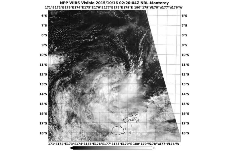
Tropical Storm 02P developed about 300 miles away from Fiji as NASA-NOAA's Suomi NPP satellite captured a visible image of the storm.
The Visible Infrared Imaging Radiometer Suite (VIIRS) instrument aboard NASA-NOAA's Suomi NPP satellite saw Tropical Storm 02P on October 16 at 0220 (Oct. 15 at 10:20 p.m. EDT). The visible-light VIIRS image showed a band of thunderstorms southwest to southeast of the center of circulation.
On October 16, 2015 at 5 a.m. EDT/0900 UTC, the center of Tropical Storm 02P was located near latitude 13.1 South and longitude 177.1 East. The storm is about 309 nautical miles north-northwest of Suva, Fiji and moving south-southwest at 10 knots (11.5 mph/18.5 kph). Maximum sustained winds were near 35 knots (40 mph/62 kph).
02P is moving southwest and is expected to strengthen a little over the next day before running into wind shear. The wind shear is expected to weaken it to a remnant low pressure area in a couple of days.
Provided by NASA's Goddard Space Flight Center


