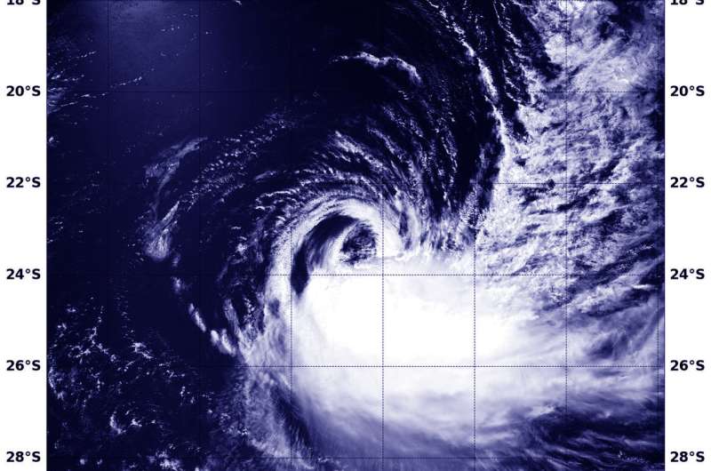
NASA finds wind shear tearing Tropical Cyclone Cebile apart

NASA's Aqua satellite passed over the Southern Pacific Ocean and found that wind shear was adversely affecting Tropical Cyclone Cebile.
The Moderate Resolution Imaging Spectroradiometer or MODIS instrument aboard NASA's Aqua satellite provided a visible image of Cebile on Feb. 5 at 3:25 a.m. EST (0925 UTC). The image showed the bulk of clouds and thunderstorms were being sheared to the southeast of the center from strong northwesterly vertical wind shear. The northwestern quadrant had a small, thin band of clouds as the storm was being battered by wind shear from that direction.
At 10 a.m. EST (1500 UTC) on Feb. 5, the center of Tropical Cyclone Cebile was located near 23.9 degrees south and 81.6 degrees east, about 1,136 nautical miles south-southeast of Diego Garcia. The depression was moving toward the south at 10.3 mph (9 knots/16.6 kph). Maximum sustained winds are near 51.7 mph (45 knots/83.3 kph) with higher gusts.
The Joint Typhoon Warning Center noted "Weakening is expected to continue as sea surface temperatures gradually drop below 80 degrees Fahrenheit (26.6 degrees Celsius) and vertical wind shear remains high (over 34.5 mph/30 knots/55.5 kph)."
Provided by NASA's Goddard Space Flight Center


