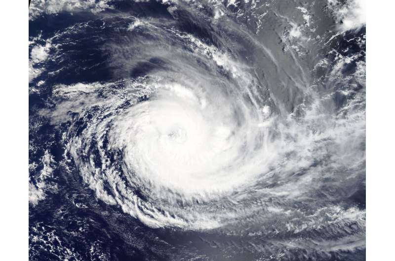
NASA tracks major Tropical Cyclone Cebile in Southern Indian Ocean

Tropical Cyclone Cebile held onto its status as a major hurricane in the Southern Indian Ocean when NASA's Aqua satellite passed overhead.
On Feb. 2, the Moderate Resolution Imaging Spectroradiometer or MODIS instrument aboard NASA's Aqua satellite captured a visible-light image of Tropical Cyclone Cebile. The storm maintained its rounded appearance and visible eye.
On Feb. 2 at 10 a.m. EST (1500 UTC) Cebile's maximum sustained winds were estimated at 110 knots (126.6 mph/203.7 kph). That makes Cebile a category three hurricane on the Saffir-Simpson hurricane wind scale. Cebile's center was located near 17.6 degrees south latitude and 75.8 degrees east longitude, about 659 nautical miles south-southeast of Diego Garcia. Cebile was moving to the south-southeast at 6 knots (6.9 mph/11.1 kph).
Cebile is moving south and is expected to continue weakening. The Joint Typhoon Warning Center forecast calls for the storm to turn to the southeast and weaken more rapidly under increasingly adverse conditions.
Provided by NASA's Goddard Space Flight Center


