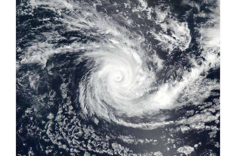
Image: Tropical Cyclone Cebile

NASA-NOAA's Suomi NPP satellite passed over the Southern Indian Ocean and captured a visible image of Tropical Cyclone Cebille. Cebille is hurricane-strength and looks like a pinwheel with a small eye surrounded by powerful bands of thunderstorms wrapped around the 5 nautical-mile-wide eye.
Cebile formed on Jan. 27 and was known as Tropical Cyclone 07S. Once it strengthened to a tropical storm it was renamed Cebile.
On Jan. 29 at 2:48 a.m. EST (0748 UTC) the Visible Infrared Imaging Radiometer Suite (VIIRS) instrument aboard NASA-NOAA's Suomi NPP satellite showed well-rounded circulation center with bands of powerful thunderstorms wrapping into the center.
At 10 a.m. EST (1500 UTC) on Jan. 29, Cebile's maximum sustained winds had increased to 126.6 mph (110 knots/203.7 kph). It was centered near 15.8 degrees south latitude and 81.0 degrees east longitude. That's about 726 nautical miles southeast of Diego Garcia. Cebile was moving to the south at 6.9 mph (6 knots/11 kph). Cebile poses no threat to land areas.
The Joint Typhoon Warning Center noted that in two days the system will slow down because of interaction with an approaching sub-tropical ridge (elongated area) of high pressure which will weaken the storm and steer it toward the southeast.
Provided by NASA


