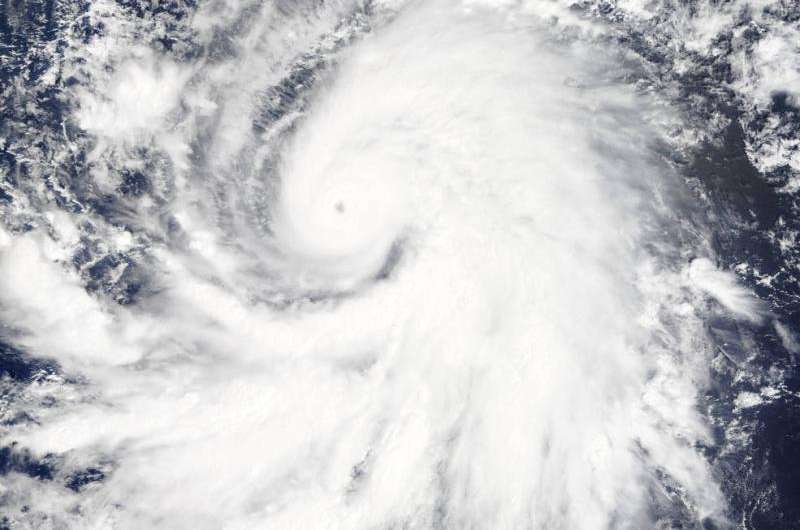
NASA sees Hurricane Olaf move into central Pacific Ocean

NASA's Terra and Aqua satellites saw Hurricane Olaf move west over the longitude line of 140 degrees that separates the Eastern Pacific from the Central Pacific. On October 20, Olaf strengthened to a Category four hurricane on the Saffir-Simpson Scale.
On Oct. 19 at 19:35 UTC (3:35 p.m. EDT) the MODIS instrument aboard NASA's Terra satellite saw Hurricane Olaf moving into the central Pacific Ocean with a visible eye. Powerful thunderstorms circled the eye and extended in a thick band in the eastern quadrant from north to south.
Later in the day at 22:35 UTC (6:35 p.m. EDT), the Atmospheric Infrared Sounder or AIRS instrument aboard NASA's Aqua satellite gathered temperature data using infrared light. AIRS data showed Olaf's cloud top temperatures exceeded -63F/-53C which indicates powerful storms with the heavy rainfall.
At 5 a.m. EDT (0900 UTC) on Oct. 20, Hurricane Olaf's center was located near latitude 10.3 north and longitude 140.4 west. That's about 1,175 miles (1,890 km) east-southeast of Hilo, Hawaii.
Despite being so far from Hawaii and because Olaf is a powerful hurricane, large swells generated by Olaf will begin to arrive along east facing shores of the main Hawaiian Islands over the next couple of days. The CPHC said that resultant surf will be large...potentially life-threatening and damaging.
Olaf is moving toward the west-northwest near 10 mph (17 kph) and the Central Pacific Hurricane Center (CPHC), who has taken over forecast responsibilities now that Olaf has crossed the 140 degree longitude line, expects Olaf to turn toward the west-northwest and then northwest by October 21.
Maximum sustained winds are near 150 mph (240 kph). Olaf is a category four hurricane on the Saffir-Simpson Hurricane wind scale. Some additional strengthening is forecast on Tuesday, Oct. 20 and fluctuations in intensity are possible Tuesday night and Wednesday. The estimated minimum central pressure is 938 millibars.
Olaf is expected to remain a major hurricane for the next couple of days and begin curving to the northeast and away from Hawaii by Friday, October 23. For updates, visit: http://www.prh.noaa.gov/cphc.
Provided by NASA's Goddard Space Flight Center


