Aqua and Terra satellites analyze Hurricane Joaquin near Bermuda

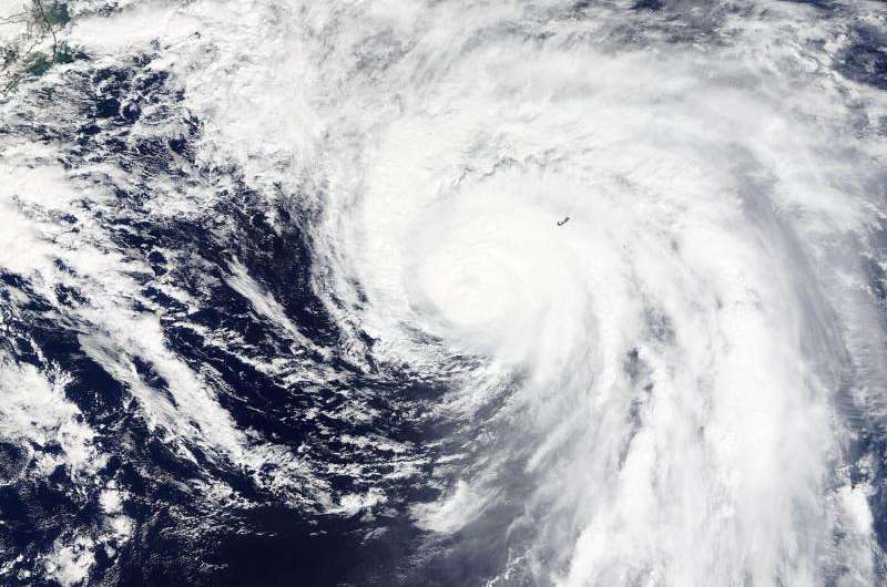
Hurricane Joaquin maintained its comma shape as it brought heavy rains, strong winds and ocean swells to Bermuda on October 5 when NASA satellites passed overhead.
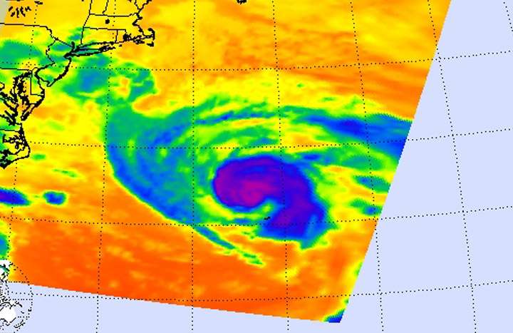
Infrared data of the hurricane was captured on Oct. 5 at 06:29 UTC (2:29 a.m. EDT) when NASA's Aqua satellite passed overhead. The Atmospheric Infrared Sounder or AIRS instrument that flies aboard Aqua took a look at the storm's temperatures and those of the surrounding ocean. At NASA's Jet Propulsion Laboratory, a false-colored infrared image was created using the AIRS data that showed powerful, heavy rainmaking storms with cold cloud tops colder than -63F/-53C in a comma shape. AIRS data showed a small area of cloud tops colder than -94F/-70C just west of the center. Those powerful thunderstorms circled the center and extended east and southeast in a thick band.
Earlier, on Oct. 4, 2015 at 15:20 UTC (11:20 a.m.) the Moderate Resolution Imaging Spectroradiometer aboard NASA's Terra satellite captured a visible image of Hurricane Joaquin that showed the northeastern quadrant of the storm was over Bermuda. The eye was still visible in the Terra image, although somewhat obscured by clouds. On October 5, microwave satellite data showed a well-defined small eye still existed, which was also seen in Bermuda Doppler radar.
At 11 a.m. EDT on October 5, a Tropical Storm Warning was still in effect for Bermuda. At that time, the center of Hurricane Joaquin was located near latitude 35.0 North and longitude 64.6 West. That's about 185 miles (300 km) north of Bermuda. Joaquin was moving toward the north-northeast near 13 mph (20 kph), and the National Hurricane Center expects a turn toward the northeast followed by a turn toward the east-northeast on Tuesday. On the forecast track, the center of Joaquin will continue to move away from Bermuda.

Maximum sustained winds are near 85 mph (140 kph) with higher gusts. Gradual weakening is forecast during the next 48 hours, and Joaquin is expected to transition to a large extratropical low pressure system on Wednesday, October 6. The estimated minimum central pressure is 964 millibars.
According to NHC, a sustained wind speed of 43 mph (69 kph) and a gust to 58 mph (93 kph) were reported at the Bermuda International Airport in the late morning on October 4.
Joaquin continued moving away from Bermuda but tropical storm conditions continued on the island.
Provided by NASA's Goddard Space Flight Center


