NASA sees Hurricane Kilo headed for International Date Line

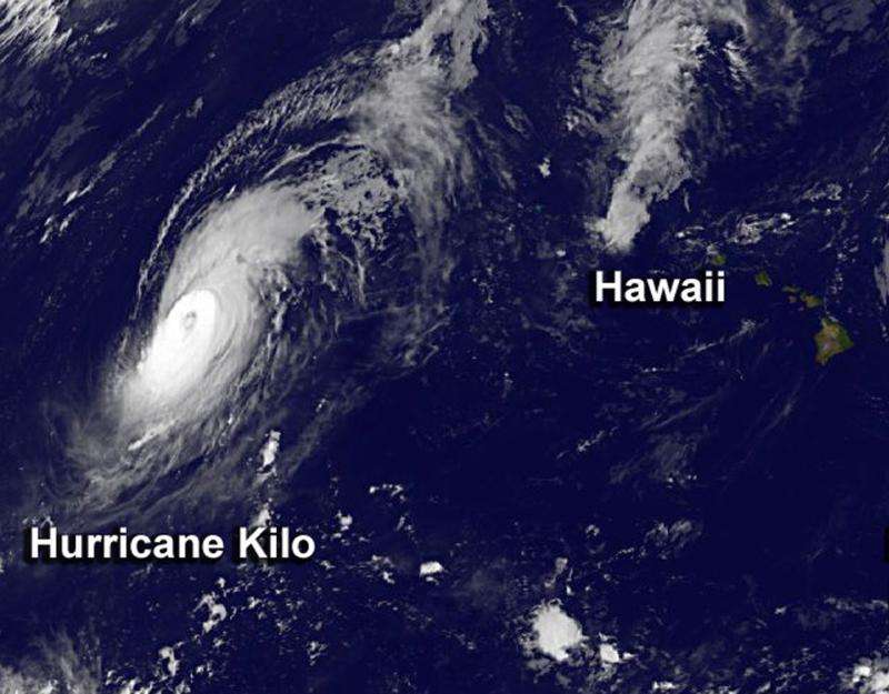
NASA's Aqua and NOAA's GOES-West satellite saw Hurricane Kilo moving west in the Central Pacific Ocean as it neared the International Date Line.
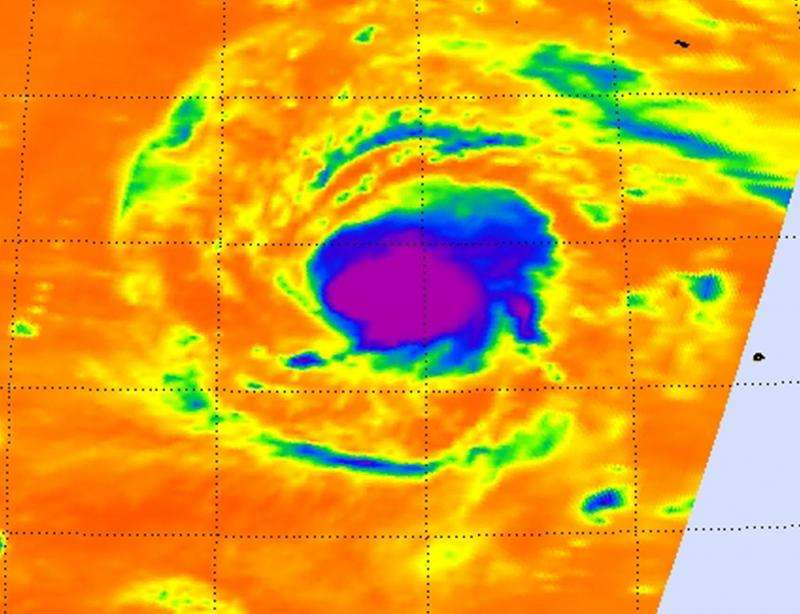
The Atmospheric Infrared Sounder or AIRS instrument that flies aboard NASA's Aqua satellite gathers infrared data that reveals temperatures. When NASA's Aqua satellite passed over Kilo on August 30, the AIRS data and showed high, cold, strong thunderstorms surrounded the center of Hurricane Kilo, and had cloud top temperatures near -63F/-53C. NASA research has shown that thunderstorms with cloud tops that cold and high in the troposphere have the potential to generate heavy rainfall.
On August 31 at 8:00 a.m. EDT an infrared image from NOAA's GOES-West satellite clearly showed that Hurricane Kilo maintained its eye.
At 11 a.m. EDT (1500 UTC/5 a.m. HST), the center of Hurricane Kilo was near latitude 21.5 north and longitude 179.3 west. That's about 480 miles (770 km) south-southwest of Midway Island. Kilo's maximum sustained winds were near 135 mph (215 kph). That means that Kilo is a category four hurricane on the Saffir-Simpson Hurricane wind scale. The Central Pacific Hurricane Center expects little change in intensity over the next two days.
Kilo is moving toward the north-northwest near 10 mph (17 kph) and is expected to continue in that direction for the next couple of days. CPHC noted that later today, August 31, Kilo may cross the International dateline into the Northwest Pacific Ocean.

For updated forecasts, visit NOAA's CPHC website: http://www.prh.noaa.gov/cphc.
Provided by NASA's Goddard Space Flight Center


