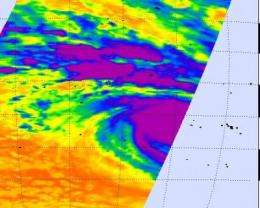
Now a hurricane, Oli passing Bora Bora

Tropical cyclone Oli has attained hurricane strength today, February 3, with maximum sustained winds near 74 mph.
At 10 a.m. ET (1500 UTC), Oli was located approximately 200 nautical miles west-northwest of Bora Bora, near 15.9 South and 154.9 West. It was moving east at 14 mph (12 knots).
The Atmospheric Infrared Sounder instrument (AIRS) on NASA's Aqua satellite captured infrared images of Oli as it passed by early this morning.
Infrared satellite imagery showed that Oli has become better organized, thus its new hurricane status. Oli has well defined banding (arms of thunderstorms that wrap into the low level circulation center of the storm.
NASA and the Japanese Space Agency's Tropical Rainfall Measuring Mission (TRMM) satellite, which measures rainfall from space, noticed an eye developing and deep convection has continued developing over the center of the storm.
Oli was kicking up waves 20 feet high in the open ocean.
Provided by NASA's Goddard Space Flight Center


