Rolling lab tracks methane to its source
McHenry Township, Lycoming County. Equipped with a gray box, a map and an SUV, Thomas Lauvaux and a team from Penn State's Department of Meteorology has been at it for hours, taking measurements and racking up the miles.
It's one in a series of road trips across northcentral and northeastern Pennsylvania, and neighboring southern New York, aimed at figuring out how much methane is in the air and how much of it is coming from the booming natural gas industry.
"Isotopes of methane will tell us how much comes from natural gas and how much comes from other methane sources, such as cows, landfills, wetlands and natural seeps," Lauvaux explains.
The mobile measurements are one of the first steps in a three-year $1.8 million study funded by the U.S. Department of Energy, a project mentioned in the March 2014 White House Climate Action Plan Strategy to Reduce Methane Emissions.
While burning natural gas to generate power produces about half the carbon dioxide of burning coal, the gas extraction process comes with its own challenges, including emitting methane—a potent greenhouse gas. "Measuring emissions of methane from a large area for a long time, and determining the source of those emissions is difficult," says Ken Davis, professor of meteorology. "But that's what we hope to accomplish with this project."
A large area, in this case, means three counties in northern Pennsylvania; a long time means two years. Zach Barkley, who worked on the project as a research assistant during the summer and is continuing as a doctoral student in meteorology this fall, says measuring atmospheric methane concentrations on the fly will help the team decide where to place tower sensors that will eventually provide emissions data over time.
The chance to work on the project was of particular interest to Barkley—giving him an opportunity to apply what he learned as an undergraduate at Penn State to an issue that literally hits home.
"I'm from Tunkhannock, a small town in northeastern Pennsylvania," he says. "Over the last few years, it's been very, very close to the center of the drilling. I've seen the town transformed from this tiny little place. I've seen all these changes happen first-hand."
From Thin Air
The team captured its initial measurements while driving past farms and forests, down winding country roads and over mountains. They measured during the day when the sun was high, and late at night after the winds had died down. They took to the road in the dead of winter and again in the summer months when the bogs and marshes had heated up and the cows were out to pasture.
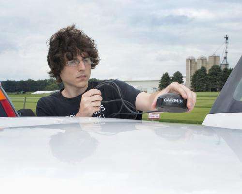
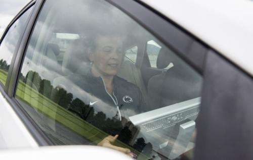
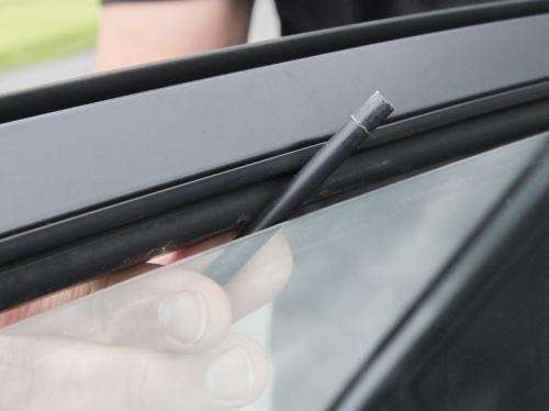
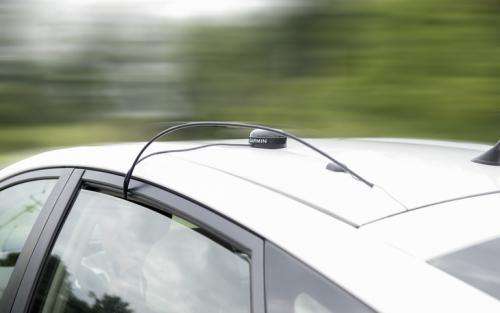
The SUV they drive is equipped with a gray box about the size of a small microwave. A thin plastic tube runs from the box through the cracked window to a sensor poking off the roof. The sensor captures raw data, which is fed back to the box, providing a real time read on fluctuating levels of carbon dioxide and methane.
The study will sample those levels in Pennsylvania and beyond at a time when hydraulic fracturing, which allows companies to tap into reserves thousands of feet below the surface, continues to grow in the Marcellus Shale region that stretches from New York to West Virginia. Including measurements from New York, where a moratorium on horizontal drilling and hydraulic fracturing is in place, will allow researchers to compare methane levels in areas where drilling is going on to those where it isn't.
"With natural gas extraction, there is a certain amount of leakage that takes place, but it isn't well quantified," Davis says. "If leakage rates are large enough, then natural gas may be a poor energy choice for climate change. If leakage rates are small, then natural gas has lower greenhouse gas emissions than coal.
"Both coal and natural gas are fossil fuels. Burning either emits greenhouse gases. But we need to minimize our climate impact, and reducing methane emissions from natural gas extraction would be progress. Measuring the emissions accurately is an important step."
Playing It Back
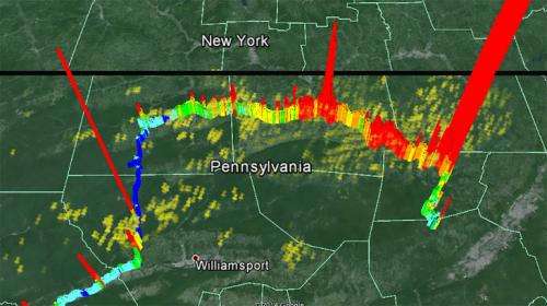
On a cold February afternoon, Lauvaux and fellow research associates Natasha Miles and Scott Richardson drove from just north of Lock Haven to the border of New York and back again, capturing data. The live feed showed when methane levels were low and when they spiked—hitting 3,000 parts per billion near one gas well. Background atmospheric levels are typically about 1,800 PPB, rising higher near sources.
"We don't really know what the main sources of methane in the area are," Lauvaux says. "It could be specific wells in the area. It could be specific facilities. So we want to have a picture of all of that."
Lauvaux, a research associate who joined Davis's research group as a postdoctoral fellow in 2009, developed the data analysis system that will be used to estimate regional methane emissions and served initially as the project's principal investigator. He has since joined NASA's Jet Propulsion Laboratory in California, but is still participating in the project.
That night, after touring farm lands and woods, the team went back out again.
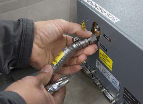
This time, they brought a 1,500-foot-long tube coiled like a snake, with them. The black rubber tube—thin enough that it could be stacked neatly in the back of the SUV—captured the air samples, which were then fed to a methane isotope analyzer back at the research station—a rented house near Tiadaghton State Forest.
This method, more sophisticated than the real-time readings, not only provides concentration levels, but characterizes the isotopes it captures. According to the researchers, the long tube full of air acts like a tape recorder, storing the atmospheric information as they're driving. "Playing it back" via the analyzer, they can tell for the miles they drove whether upswings in methane measurements were mostly from cows or from oil and gas. That's because the methane from a cow burp has a different isotopic composition than that emitted by oil and gas deposits.
After the drive-arounds, the data on atmospheric conditions will be coupled with maps of gas wells, compressor stations and pipelines, in addition to data that shows where other contributors to methane levels—wetlands, landfills and farms—are located.
The combined information will help the team decide where to station the continuously operating, tower-based sensors that will enable the researchers to determine natural gas methane emissions over the entire three-county region. The tower sensors will provide a flow of data on methane levels over time—in cold months when wetlands are dormant and cows are in barns and in warm months when biological sources are emitting more methane. The seasonal changes help the researchers isolate how much is coming from natural gas.
Changes in wind direction will also help. "We won't need to move the instruments because the wind is changing every day," says Lauvaux. "When the wind is from the north, we can see everything coming from the north of the tower. Every day you have a different wind direction, so you can scan the area without moving."
Continuous Monitors
The tower observations will continue over at least two years. Once the team has assembled all that data, Davis's group will input the measurements into Lauvaux's analysis system to quantify how much methane has been leaking into the atmosphere.
The method being used is similar to one that Davis and the Penn State team employed as part of a multi-institution, long-term study of carbon dioxide fluxes over the corn fields of the upper Midwest, and that they're currently using to document greenhouse gas emission rates in the city of Indianapolis. In each case, they depend on a thorough understanding of winds and atmospheric mixing, combined with the sensor network, to compute regional emissions.
"We have done this with other greenhouse gas emissions, so the methodology has been tested. But we haven't applied that methodology to this problem," says Davis, who is also a faculty member in the Earth and Environmental Systems Institute.
They picked northeastern Pennsylvania for the study because, while southwestern Pennsylvania is also seeing a natural gas boom, that region also has oil and coal beds.
"This area only has dry gas," Lauvaux says. "So we know the natural gas emissions are coming from the gas."
While there have been other studies of methane emissions from natural gas extraction, Davis says, the conclusions drawn from that work have been inconsistent and are limited by relying on localized methods that collect data for only hours or days. The Penn State study represents important progress towards establishing continuous monitoring of the greenhouse-gas impact of this emerging industry.
Provided by Pennsylvania State University


