Measuring how climate models calculate the effects of clouds on Earth's warming

Using ten years of data gathered at three unique measurement sites, scientists at Pacific Northwest National Laboratory and Lawrence Livermore National Laboratory found that global climate models are not representing just how much clouds mask the sun's warming energy. And for the first time, scientists used data on the spatial coverage, height, and transparency of the clouds to inform climate models. They found the relative monthly and annual differences among three cloud fraction datasets at each site are small. However, comparing observations with a dozen global models shows that cloud coverage is significantly misrepresented in the models, by up to 150 percent at one site.
Ever stood under the shadow of a cloud on a sunny day? Then you already know that the amount of clouds covering the Earth is a primary factor on the warming or cooling of the surface. The sun's energy, or solar radiation, is the primary source of Earth's warming. But clouds get in the way, changing the amount of energy reaching the Earth's surface. Scientists want to know just how much energy is reaching the surface and how much is reflected away or absorbed by clouds. Getting an accurate measurement of clouds, or how much surface they shade at any one time, called cloud fraction, will help scientists predict how and where clouds influence Earth's warming and cooling. Beyond warmth and cooling, getting an accurate picture of cloud cover will impact predictions of precipitation and air quality around the world.
"Everyone agrees that clouds are the most uncertain agent for prediction in climate models. That's why the U.S. Department of Energy has made a substantial investment in collecting cloud and radiation observational data," said Dr. Yun Qian, atmospheric scientist and principal investigator on the study. "In our study, we have taken the raw data and showed how it's ultimately valuable for evaluating cloud fraction, height, and their radiative effect. We then compared this data with a collection of climate models to answer the questions, ‘Where should you pay more attention?' and ‘How well do current global models include clouds and cloud fraction?'"
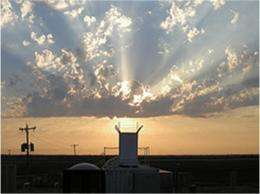
Researchers gathered data from three Atmospheric Radiation Measurement (ARM) Facility locations: North Slope of Alaska, Southern Great Plains (in Oklahoma), and Tropical Western Pacific. These represent the broad range of climate conditions around the world. The locations each house large groups of atmospheric instruments. Data for this study were gathered by instruments that measured cloud fraction, such as the total sky imager (TSI) which captures a hemispheric view of cloud cover during daylight hours, radar and lidar, used to measure cloud depth and height in one vertical location, and radiometers that measure the shortwave and longwave radiative fluxes.
These data sets were compared among each other at each site to gain insight on how closely the different measurements of cloud fraction are correlated with each other. The inter-comparison revealed relative small monthly and annual differences among the three datasets within each site. The observational data was then compared to cloud fraction representations in a set of 12 global circulation models (GCMs) used in the Intergovernmental Panel of Climate Change (IPCC) reports. Scientists were interested in determining the inter-model deviation and model bias against observation. In addition, they diagnosed potential differences among the GCMs in other cloud optical properties, including cloud transparency, height, and density. They found that the climate models tend to have larger discrepancies from observations for the cloud variables that also have larger inter-model differences.
The cloud fraction varied at different heights, which has a different heating effect changing the overall climate circulation. Researchers have gained new insight on ways to improve the prediction of clouds in global climate models.
Using the ARM cloud and radiation data together with satellite data, scientists at PNNL will be working on the prediction of cloud properties in CAM5, the newest version of the Community Atmosphere Model, a global atmospheric process model.
"This research will spark improvements for each global model on how to use the ARM cloud fraction data," said Qian.
More information: Qian Y, et al. 2012. "Evaluation of Cloud Fraction and Its Radiative Effect Simulated by IPCC AR4 Global Models Against ARM Surface Observations," Atmospheric Chemistry and Physics, 12, 1785-1810. DOI:10.5194/acp-12-1785-2012
Journal information: Atmospheric Chemistry and Physics
Provided by Pacific Northwest National Laboratory


