This article has been reviewed according to Science X's editorial process and policies. Editors have highlighted the following attributes while ensuring the content's credibility:
fact-checked
trusted source
proofread
Drones offer new perspective on vulnerable tide-exposed coral reefs

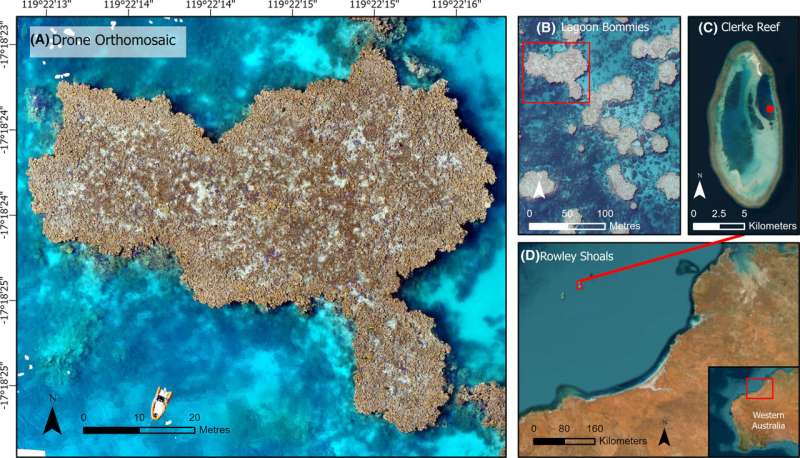
A new study has used drone technology and cutting-edge analytical methods for the first time to map the intertidal coral reefs of the Rowley Shoals off the Kimberley coast of Western Australia.
The research, by The University of Western Australia and the Australian Institute of Marine Science (AIMS) and published in Remote Sensing in Ecology and Conservation, highlights the potential of drones as a new tool to monitor intertidal reefs, which are usually challenging to access and therefore under-represented in traditional monitoring programs.
Intertidal coral reefs are a crucial component of many reef systems and play a significant role in overall reef health. Their habitats experience dynamic changes between low and high tides, and organisms must adapt to survive both underwater and above-water conditions.
Co-author Dr. Sharyn Hickey, from UWA's Oceans Institute and Center for Water and Spatial Science, said this type of reef had shown evidence of thermal adaptation and higher resistance to coral bleaching than coral in subtidal environments.
"In the few studies conducted on intertidal reefs, the main impacts on them were found to be marine heat waves driven by climate change and sea level rise, so they are an important element of coral reef systems to get to know better," Hickey said.
Lead author, UWA graduate research assistant Amy Stone, compared machine learning and AI approaches to analyze drone-captured imagery of 3D reef structure, finding that the simplest methods were the most accurate in estimating coral cover.
"The findings are important because we have lacked comparative studies to know how to best optimize drones as a tool to map coral reefs," Stone said.
AIMS' Dr. Ben Radford, a senior researcher on the paper, said the work opened doors for more comprehensive and efficient monitoring of these vulnerable intertidal ecosystems.
"This will aid in conservation efforts and further our understanding of their role within broader reef systems," Radford said.
"By harnessing drone technology, we can enhance our understanding of these critical ecosystems and inform targeted management strategies."
An interactive overview of the study is available here.
More information: Amy Stone et al, Mapping emergent coral reefs: a comparison of pixel‐ and object‐based methods, Remote Sensing in Ecology and Conservation (2024). DOI: 10.1002/rse2.401
Provided by University of Western Australia


