January 16, 2024 report
This article has been reviewed according to Science X's editorial process and policies. Editors have highlighted the following attributes while ensuring the content's credibility:
fact-checked
peer-reviewed publication
trusted source
proofread
New details of the history of the Melanesian Border Plateau revealed by undersea rocks

A team of oceanographers, geologists and Earth scientists affiliated with multiple institutions in the U.S. and Germany has learned more about the history of the Melanesian Border Plateau by studying rocks they retrieved from the ocean floor in 2013 along with seismic data. Their paper is published in the journal Earth and Planetary Science Letters.
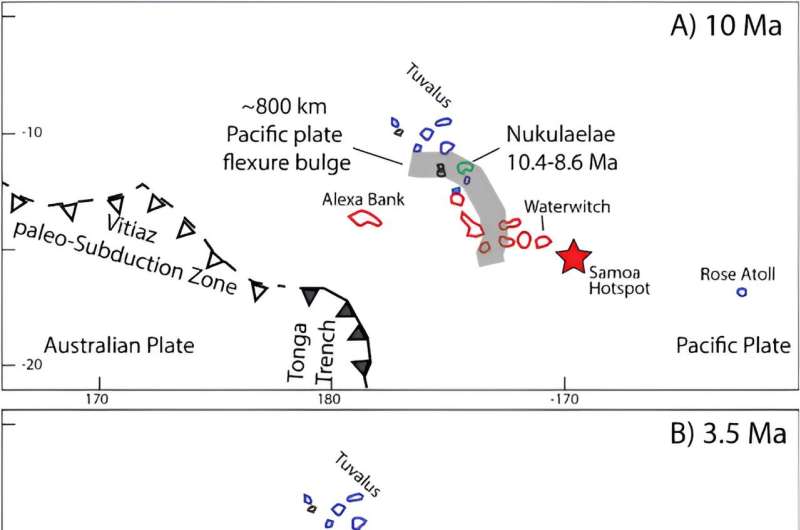
The Melanesian Border Plateau is a large region (85,000 square miles) on the ocean floor in the Pacific Ocean, near the Solomon Islands, made up of seamounts, ridges and volcanic guyots. In this new effort, the research team studied the collected rock samples. The researchers learned more about the history of the region going as far back as 120 million years ago. They also identified four distinct phases of volcanism in the region, each with a different backstory, that has led to the features observed today.
The researchers carried out a five-week expedition to the region in 2013 to collect rock samples from the sea floor 600 meters below. In the lab, they found that many of the rocks had been pushed from below the seafloor by volcanic activity, allowing the researchers to learn more about its history.
The rocks showed that the plateau got its start approximately 120 million years ago due to a flood of basaltic lava—the result was the formation of what is now known as the Robbie Ridge. They also showed that approximately 45 million years ago, a seamount was formed when the Rurutu-Arago hotspot began seeping up through the ocean floor.
The ancient seamount was likely tall enough to breach the surface. But over the years, it eroded, preventing it from breaching—but approximately 13 million years ago, the seamount moved over a different hotspot, which built up the seamount again. This time, it led to the formation of what are now the Samoan Islands. Then, approximately 3 million years ago, tectonic movement led to volcanic eruptions that changed the landscape of the seafloor once again.
The researchers plan to continue their work, looking to map out the history of other undersea geographical areas and expand the knowledge base of the world's oceans.
More information: Kevin Konrad et al, Four distinct pulses of volcanism built the Melanesian Border Plateau: Implications for oceanic mid-plate superstructure formation, Earth and Planetary Science Letters (2023). DOI: 10.1016/j.epsl.2023.118549
Journal information: Earth and Planetary Science Letters
© 2024 Science X Network


